
|
ArcView Shapefiles:GIS layers overview |
Interpretive Layers
This CD-ROM contains various GIS layers for the study area. In general terms these layers fall into one of three forms: vector lines, points or polygons. The vector data consist of line information (e.g. ship's track line, bathymetry contours), point data (e.g. core information), and polygon layers such as the interpretation of depositional units for the study area. Available coverages have been archived in ESRI's ArcView shapefile format.
Select a data type from the table below to view detailed information.
The detailed information includes links to the various data components
in that group as well as detailed metadata for the indivdual coverages.
These layers are interpretive overlays created by the senior author.
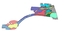
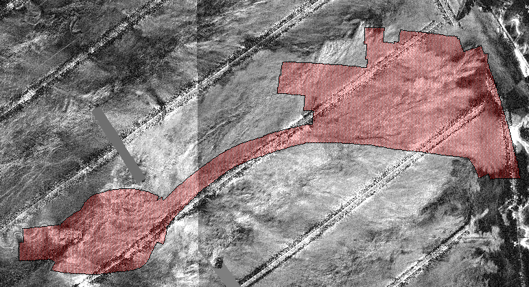
INTERPRETIVE LAYERS Layer Name - Description ArcView Shapefiles deposits - shapefile containing interpretation of the depositional units of the Mississippi Fan metadataDirectory: data/interp
browse graphic
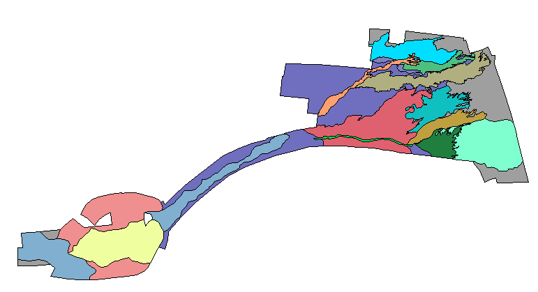
interp.dbf interp.shp interp.shx zip file channel - polyline coverage tracing the meandering channel system of the Mississippi Fan metadataDirectory: data/interp
browse graphic
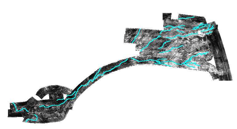
channel.dbf channel.shp channel.shx zip file lobe - shapefile containing interpretation of the extent of the depositional lobe of the Mississippi Fan metadataDirectory: data/interp
browse graphic
lobe.dbf lobe.shp lobe.shx zip file
These layers represent navigation field data collected during the cruise that have been converted to a GIS data layer. The navigation data is also available as an ASCII text file (data/nav.txt) in the merge-merge format.Cores collected during the second leg of the field study are described separately here.
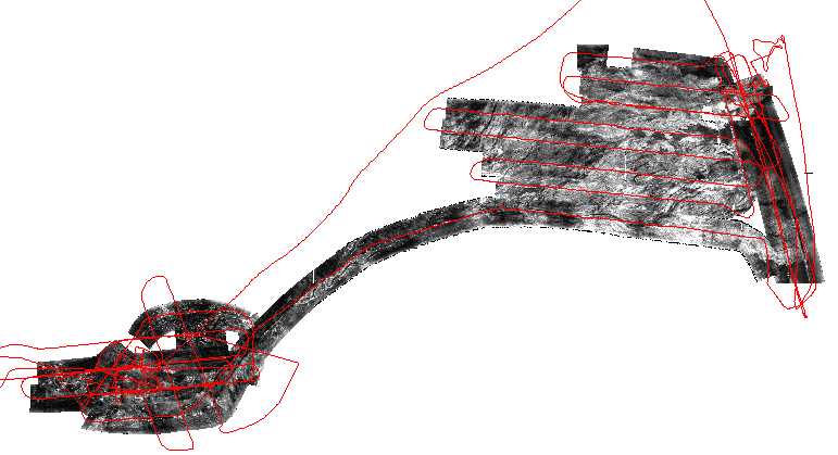
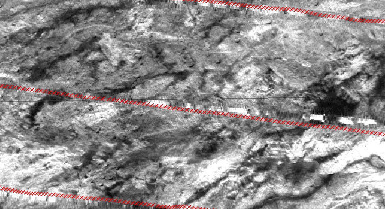
DATA LAYERS Layer Name - Description ArcView Shapefiles trackl - vector line coverage of R/V FARNELLA 90-3 trackline. metadataDirectory: data/nav
browse graphic
trackl.dbf trackl.shp trackl.shx zip file trackp - point coverage with date and time attributes of R/V FARNELLA 90-3 trackline metadataDirectory: data/nav
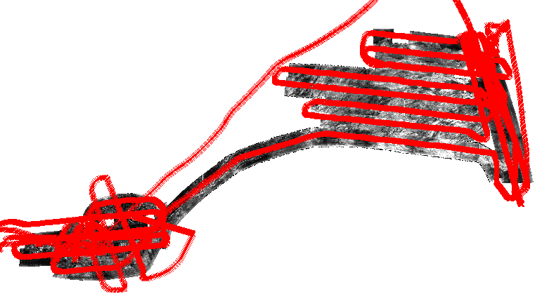
browse graphic
detail graphic
trackp.dbf trackp.shp trackp.shx zip file
The following are various miscellaneous GIS overlays that have been used in the ArcView project views available on this CD-ROM.
| Layer Name - Description | ArcView Shapefiles | ||||
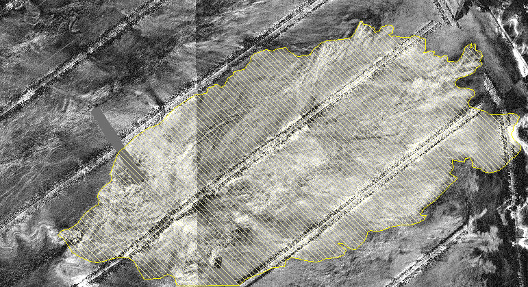
msfan
- a polygon coverage showing the extents of the SeaMARC 1A data.
This coverage may be displayed over the GLORIA sidescan mosaic to identify
the SeaMARC 1A data area.
metadataDirectory: data/misc |
|
||||
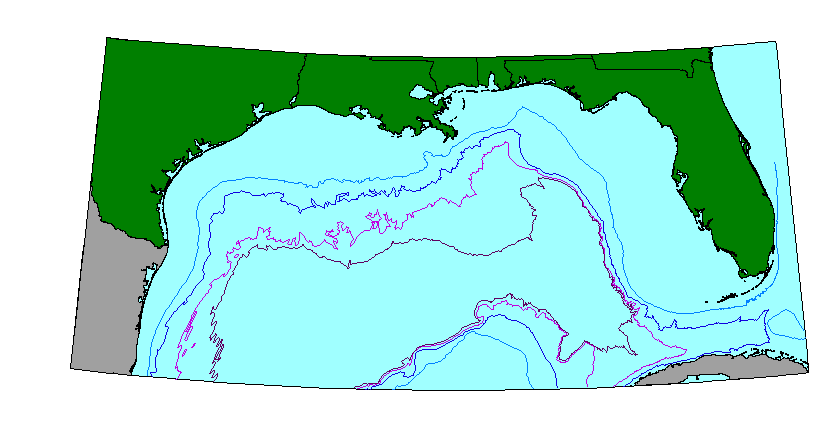
bathyc
- 200, 1000, 2000 and 300m bathymetric contour lines for the Gulf of Mexico.
metadataDirectory: data/bathyc |
|
||||
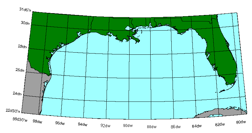
gratic
- 2 degree graticule used in the Gulf of Mexico overview.
metadataDirectory: data/misc |
|
||||
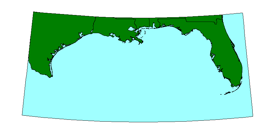
USA
- land mass showing the US coastal states around the Gulf of Mexico project
area.
metadataDirectory: data/coast |
|
||||
sabody
- Land mass showing Mexico and Cuba for the Gulf of Mexico project area.
metadataDirectory: data/coast |
|
||||
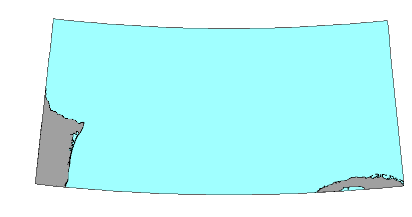
bckgrnd
- Cyan colored background showing the extent of the Gulf of Mexico project
view area. This coverage is used as the backdrop for the views.
metadataDirectory: data/misc |
|