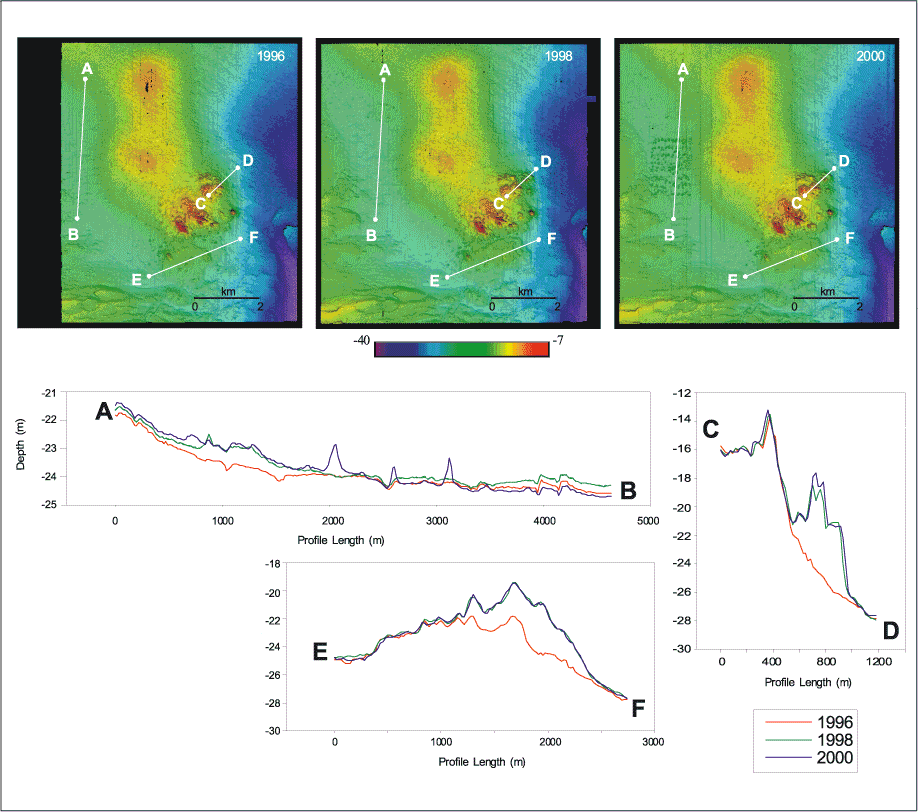
Figure 3.
Top: Plan view of the color-coded topography in 1996, 1998, and 2000.
Bottom: Topography along three transects in the Historic Area Remediation Site showing differences between the 1996, 1998, and 2000 surveys. Transect A-B shows the changes in topography in Area 6 and Area 7 (see Figure 2 ) where remediation has provided a cover of about 0.5 m. Transect C-D shows the accumulation of material caused by placement of material in Area 1 (see Figure 2) on the eastern edge of the Mud Dump Site between 1996 and 1998. Transect E-F shows the changes in topography across the two capping projects in the southern part of the Mud Dump Site (Area 5). Black indicates areas of no data.