USGS Open-File Report 03-474, G1-03-GM, Gas Hydrates Cruise Report, R/V Gyre, 1-14 May 2003, Northern Gulf of Mexico
Title Page
Abstract
Introduction
Acknowledgments
GEOLOGIC SETTINGS
Cruise Objectives
Cruise Strategy
Instrumentation
Data Processing
Data Handling
Marine Mammal Mitigation
Operational Summary
Success in Meeting Objectives
Summary
References
Appendices
1. Multichannel
Line Statistics
2. Summary of
Digital Data
3. Marine
Mammal
Documents
4. Science
Roster
5. Ship Roster &
Specifications
6. Photo Gallery
Geologic Settings
The Gulf of Mexico has been classified as a small ocean basin (Menard, 1967), and the northern Gulf of Mexico consists of a wide shelf, shelf break, slope and rise morphology found on passive continental margins. The present physiography of the slope is dominated by salt tectonics, in which hummocky bathymetry is dominated by irregularly shaped salt withdrawal basins and the intervening structural highs that are often underlain by diapers (Bouma and Roberts, 1990; Winker and Booth, 2000). Terrigenous siliclastic deposition, dominated in the Pleistocene and Holocene by the Mississippi River, characterizes most of the basins and intra-basin settings (Winker and Booth, 2000). During its evolution, the Mississippi River depositional path variously followed the Alaminos, Keathley, and Mississippi Canyon pathways (Bryant and others, 1990).
 |
| Figure 1. Click on figure for larger image with caption. |
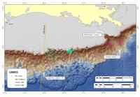
The two sites of this cruise represent contrasting geological environments. Keathley Canyon 195 is on the mid-slope near the junction of four mini-basins at about 1,300 m water depth where salt tectonics is the dominant control on the shallow morphology. Atwater Valley 14, also in about 1,300 m water, is on the floor of the Mississippi Canyon(Fig. 1) where drainage from the Mississippi River has been the dominant control on the shallow structure and geometry.
The Gulf of Mexico presents a unique setting for gas hydrates when compared to most other continental margins of the world. Both oil and gas are actively produced in the Gulf, and abundant leakage (i.e., venting) provides a thermogenic source of gas to the shallow section for forming hydrates (Roberts, 2001), especially much rarer forms of structure II hydrate (Sassen and others, 2001). Hydrates in the northern Gulf have also been characterized primarily from studies of hydrate mounds on the sea floor (Roberts and others, 1992; Roberts, 2001) rather than the more commonly known seismic indicator of hydrates, the Bottom Simulating Reflection (BSR). The lack of a BSR is puzzling, given the abundant gas in the Gulf, although observations of BSRs in Walker Ridge (McConnell and Kendall, 2003) and elsewhere in the Gulf are now beginning to be reported. The few BSR's that have been observed in the northern Gulf are weaker and less recognizable when compared with the BSRs that characterize well-known gas hydrate regions such as the Blake Ridge (Dillon and Paull, 1983), Hydrate Ridge (Trehu and others, 1999), and Nankai trough (Arato and others, 1996).
The Gulf of Mexico is also unique because of the extreme salt tectonics that occur. This widespread salt may be related to the paucity of BSRs in two fundamental ways: salt is an inhibitor to hydrate formation, so that the presence of abundant shallow salt on the continental slope may act to limit hydrate formation (Paull and others, 2003). The salt tectonics and related faulting and fluid/gas venting may also distort the base of the gas hydrate stability zone, limiting the subjacent accumulation of laterally continuous zones of free gas necessary for a recognizable BSR (Cooper and Hart, 2003). The complexity of the geologic setting together with the abundant hydrocarbon development are factors which set the Gulf apart from other hydrate settings.
