U.S. Geological Survey Open-File Report 2012-1099
Summary of Oceanographic and Water-Quality Measurements near the Blackwater National Wildlife Refuge, Maryland, 2011
/ Title Page / List of Figures / Conversion Factors / Abstract / Introduction / Instruments / Site Description / Mooring Log / Results / Acknowledgments / References Cited / Appendix
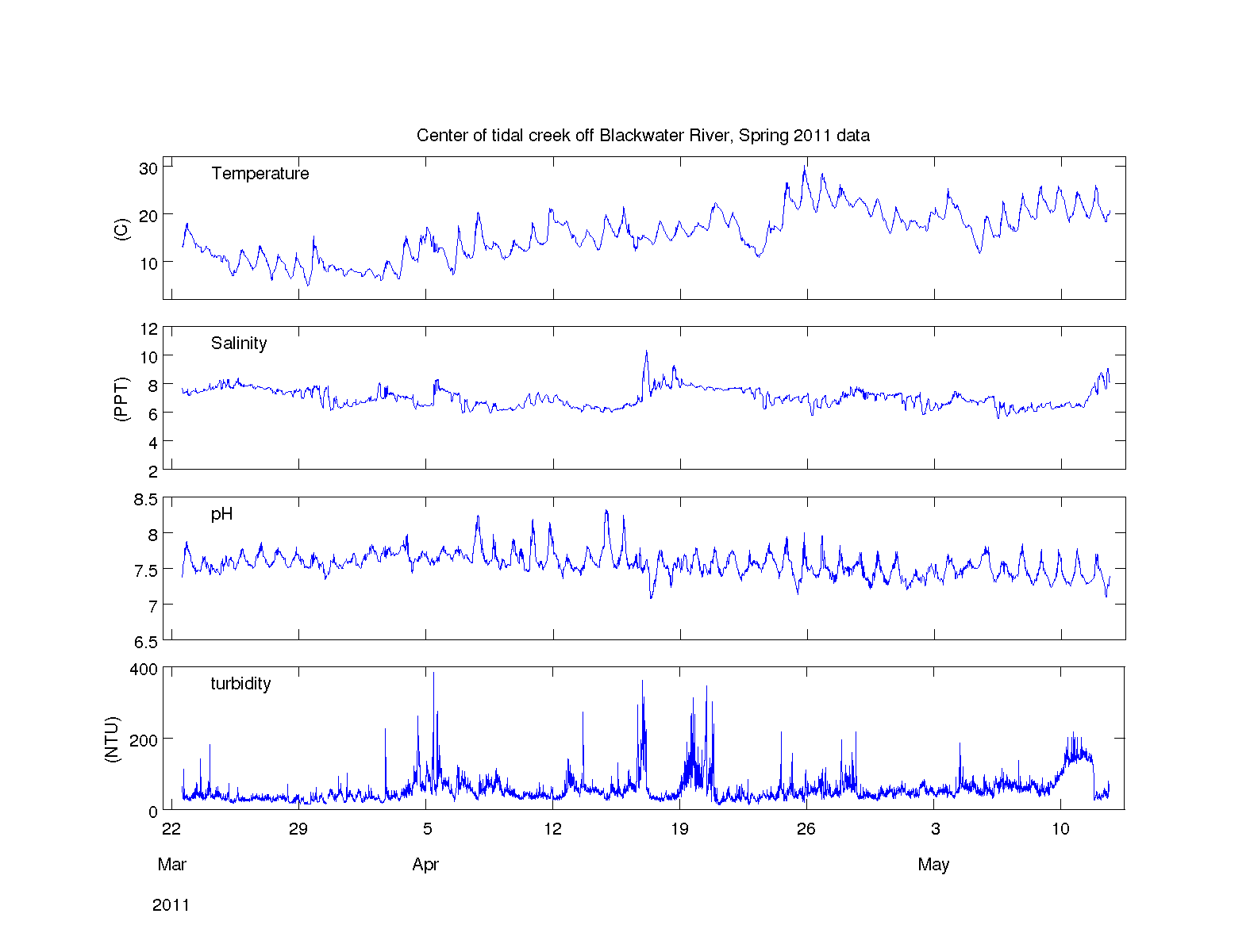
Figure 9. Temperature, salinity, pH and turbidity data from a pole-mounted YSI 6920 sensor at the center of a tidal creek off Blackwater River (mooring 904),deployed 0.35 meters above bottom in the spring of 2011.
Download the full size image in PDF format.
To view files in PDF format, download a free copy of Adobe Reader.