U.S. Geological Survey Open-File Report 2012-1219
Carolinas Coastal Change Processes Project data report for nearshore observations at Cape Hatteras, North Carolina, February 2010
![]()
Title Page | List of Figures | Conversion Factors | Abbreviations | Abstract | Introduction | Background | Field Program | Instrumentation | Mooring Identification and Field Mooring Log | Data Processing | Data File Identifiers | Digital Data Files| Supporting Observations| | Data Available | Tidal Analysis | Digital Data Files | Time-Series Plots | Acknowledgments | References Cited | Matlab® m-files | Metadata | Index |
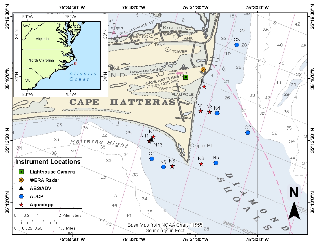 |
Download the full size image in PDF format (106 KB). To view files in PDF format, download a free copy of Adobe Reader.
|
Accessibility FOIA Privacy Policies and Notices

![]() U.S. Department of the Interior |
U.S. Geological Survey
U.S. Department of the Interior |
U.S. Geological Survey
URL: http://pubsdata.usgs.gov/pubs/of/2012/1219/figure1.html
Page Contact Information: GS Pubs Web Contact
Page Last Modified: Monday, 26-Aug-2013 12:10:59 EDT
