Skip past header information
USGS - science for a changing world

U.S. Geological Survey Open-File Report 2012-1219

Carolinas Coastal Change Processes Project data report for nearshore observations at Cape Hatteras, North Carolina, February 2010


Digital Data Files

Skip past contents information

Provided below are links to download the processed data as well as contacts to inquire after data collected by co-authors. The data file names are described on the Data File Identifiers page and the mooring log page

Nearshore Data Files

Site Filename
N1 8771aqdb-cal 8771aqd-a 8771aqwp-cal
N2 8781aqdb-cal 8781aqd-a 8781aqwp-cal
N3 8791aqdb-cal 8791aqd-a 8791aqwp-cal
N4 8801Awhb-cal 8801Bwhb-cal 8801wh-a 8801adwp-cal
N5 8641Awhb-cal 8641Bwhb-cal 8641wh-a 8641adwp-cal
N6 8651aqdb-cal 8651aqd-a 8651aqwp-cal
N8 8751aqdb-cal 8751aqd-a 8751aqwp-cal
N9 8711Awhb-cal 8711Bwhb-cal 8711wh-a 8711adwp-cal
N11 8661aqdb-cal 8661aqd-a 8661aqwp-cal
N12 8671Aaqdb-cal 8671Baqdb-cal 8671Aaqd-a 8671Baqd-a
8671Aaqwp-cal 8671Baqwp-cal
N13Data from N13 is available but must be obtained from the University of South Carolina. Please see WERA contact information below.

Offshore Data Files

Site Filename
O18721whb-cal 8721wh-a 8721adwp-cal
O2 8731whb-cal (A, B, C, D, E) 8731wh-a 8731adwp-cal
O3 8741whb-cal (A, B, C, D, E) 8741wh-a
8741Aadwp-cal 8741Badwp-cal

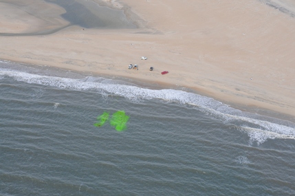
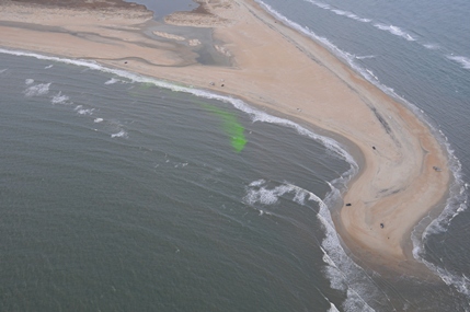
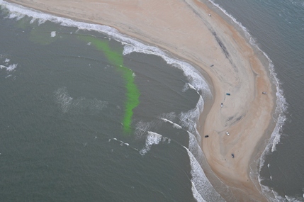
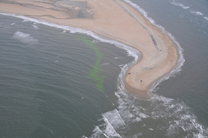
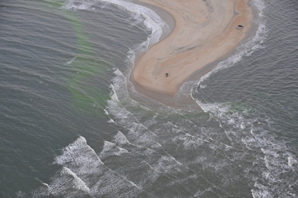
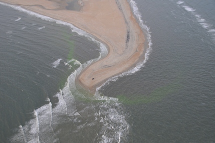
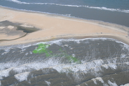
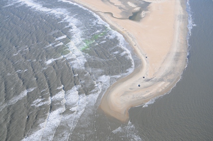
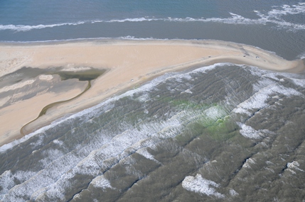
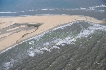
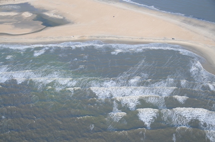
Selected Aerial Photographs for the Surface Dye Study

Aerial photography by Dann Blackwood, U.S. Geological Survey.

Photographs in chronological order from left to right.

Dye Study, First Flight
Location map for Cape Hatteras, NC. Markers are placed to identify locations of  moorings, WERA radar and camera system.Location map for Cape Hatteras, NC. Markers are placed to identify locations of  moorings, WERA radar and camera system.
Dye Study, Second Flight
Location map for Cape Hatteras, NC. Markers are placed to identify locations of  moorings, WERA radar and camera system.Location map for Cape Hatteras, NC. Markers are placed to identify locations of  moorings, WERA radar and camera system.

Contact Information

Instrument, data, and processing descriptions for site N13, the lighthouse camera system, Wellen radar (WERA), nearshore surveys and benthic unattended generator (BUG) are not included in this report. For inquiries regarding site N13, the lighthouse camera system, WERA, nearshore surveys, and BUG data please see the contact information below.

Lighthouse Camera System

Camera data were collected by Georgia Tech Savannah. Camera data inquiries please contact:

Kevin A Haas, associate professor
Georgia Tech Savannah
210 Technology Circle
Savannah, GA 31407-3039
Telephone: (912) 966-7929
Fax: (912) 966-7928
Email: khaas@gatech.edu

WERA and N13

WERA and N13 data were collected by the University of South Carolina. WERA and N13 data inquiries please contact:

George Voulgaris
Department of Earth & Ocean Sciences
University of South Carolina
Columbia, SC 29208, USA
Telephone: (803) 777-2549
Fax: (803) 777-6610
Email: gvoulgaris@geol.sc.edu
Internet: www.geol.sc.edu/gvoulgar/cpsdlab.html

CLARIS and LARC Nearshore Surveys

Nearshore survey data were collected by the Field Research Facility in Duck, NC. Nearshore survey data inquiries please contact:

Dr. Jesse McNinch, director
Field Research Facility
Engineering and Research Development Center - CHL
Duck, NC 27949
Telephone: (252) 261-6840 ext. 243

BUG

BUG data were collected by the Naval Research Laboratory. BUG data inquiries please contact:

Dr. Jeffrey W. Book
Email: jeff.book@nrlssc.navy.mil


Accessibility FOIA Privacy Policies and Notices

Take Pride in America logo USA.gov logo U.S. Department of the Interior | U.S. Geological Survey
URL: http://pubsdata.usgs.gov/pubs/of/2012/1219/files.html
Page Contact Information: GS Pubs Web Contact
Page Last Modified: Monday, 26-Aug-2013 12:17:13 EDT