Open-File Report 2014–1018
![]() Title |
List of Figures |
Conversion Factors |
Abstract |
Introduction |
Setting |
Methods |
Bathymetry |
Sidescan Sonar |
Sediments |
Bottom Photography |
GIS Data Catalog |
Summary |
Acknowledgments |
References |
Contacts |
Index
Title |
List of Figures |
Conversion Factors |
Abstract |
Introduction |
Setting |
Methods |
Bathymetry |
Sidescan Sonar |
Sediments |
Bottom Photography |
GIS Data Catalog |
Summary |
Acknowledgments |
References |
Contacts |
Index
 |
||
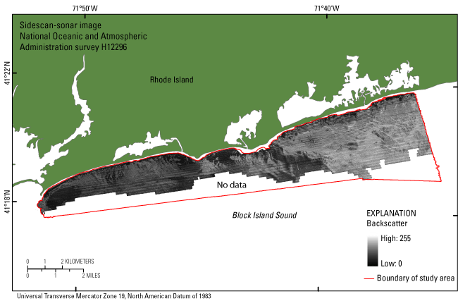
Figure 16. Sidescan-sonar image of National Oceanic and Atmospheric Administration survey H12296. The lighter toned areas represent high backscatter and, typically, coarser grained sediment; darker toned areas represent low backscatter and, typically, finer grained sediment. Sidescan-sonar data was not collected in the southern parts of the study area. |
||

![]() U.S. Department of the Interior |
U.S. Geological Survey
U.S. Department of the Interior |
U.S. Geological Survey
URL: http://pubsdata.usgs.gov/pubs/of/2014/1018/html/fig16.html
Page Contact Information: GS Pubs Web Contact
Page Last Modified: Wednesday, 07-Dec-2016 19:33:56 EST
