Open-File Report 2014–1018
![]() Title |
List of Figures |
Conversion Factors |
Abstract |
Introduction |
Setting |
Methods |
Bathymetry |
Sidescan Sonar |
Sediments |
Bottom Photography |
GIS Data Catalog |
Summary |
Acknowledgments |
References |
Contacts |
Index
Title |
List of Figures |
Conversion Factors |
Abstract |
Introduction |
Setting |
Methods |
Bathymetry |
Sidescan Sonar |
Sediments |
Bottom Photography |
GIS Data Catalog |
Summary |
Acknowledgments |
References |
Contacts |
Index
 |
||
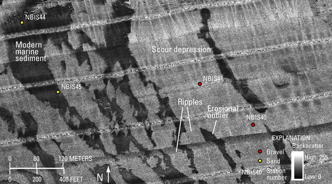
Figure 17. Detailed sidescan-sonar image of high-backscatter scour depressions and low-backscatter erosional outliers of modern marine sediment. In places, ripples can be seen on the floors of the scour depressions. Image also shows locations of stations NBIS40, NBIS41, NBIS44, and NBIS45. Location of image is shown in figure 11. |
||