Open-File Report 2014–1018
![]() Title |
List of Figures |
Conversion Factors |
Abstract |
Introduction |
Setting |
Methods |
Bathymetry |
Sidescan Sonar |
Sediments |
Bottom Photography |
GIS Data Catalog |
Summary |
Acknowledgments |
References |
Contacts |
Index
Title |
List of Figures |
Conversion Factors |
Abstract |
Introduction |
Setting |
Methods |
Bathymetry |
Sidescan Sonar |
Sediments |
Bottom Photography |
GIS Data Catalog |
Summary |
Acknowledgments |
References |
Contacts |
Index
 |
||
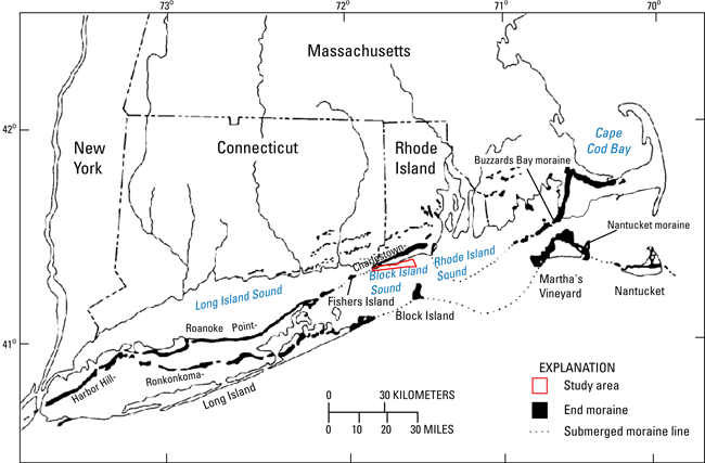
Figure 2. Map of end moraines (black-shaded polygons) and submerged ridges (dashed lines) in southern New York and New England (modified from Gustavson and Boothroyd, 1987) with the study area (red-outline polygon). The Ronkonkoma-Block Island-Nantucket terminal moraine represents the maximum advance of the Laurentide Ice Sheet about 20,000 to 28,000 years ago. The Harbor Hill-Roanoke Point-Charlestown-Buzzards Bay end moraine represents a retreated ice-sheet position from about 18,000 to 23,000 years ago (Uchupi and others, 2001; Balco, 2011). |
||

![]() U.S. Department of the Interior |
U.S. Geological Survey
U.S. Department of the Interior |
U.S. Geological Survey
URL: http://pubsdata.usgs.gov/pubs/of/2014/1018/html/fig2.html
Page Contact Information: GS Pubs Web Contact
Page Last Modified: Wednesday, 07-Dec-2016 19:33:58 EST
