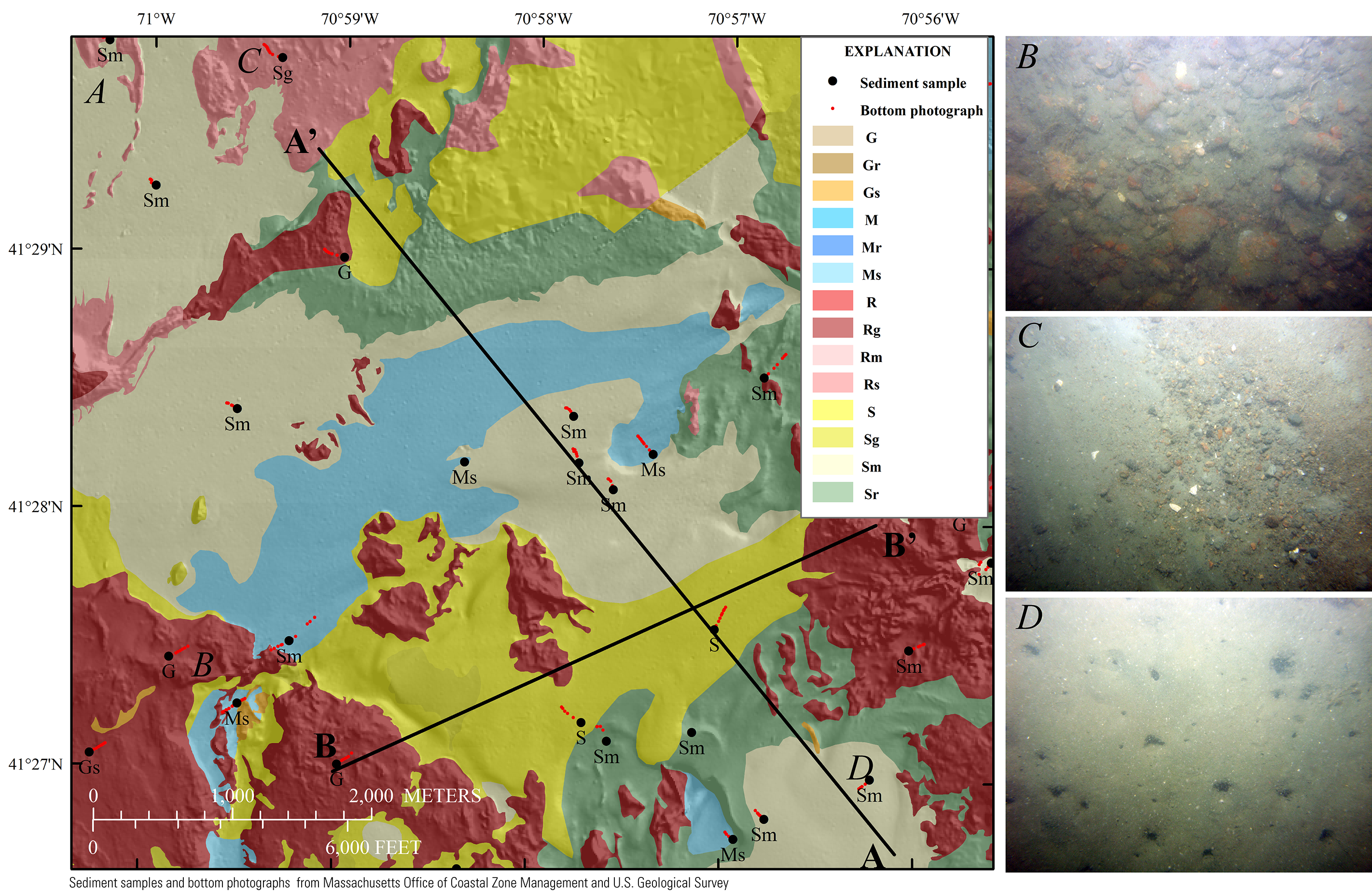
Figure 18. A, Sediment textures within an approximately 6.5- by 6-kilometer area in western Buzzards Bay (see fig. 17 for location). The bathymetry hillshade relief map underlying the sediment texture layer is modified from the composite bathymetry of Buzzards Bay (fig. 3). The pink polygons separate areas of high confidence level (larger area) from low confidence level (smaller areas). The location of seismic profiles A–A' and B–B' from figures 10 and 11 is shown here. B, A photograph of the sea floor showing a gravel-cobble pavement within an area classified as rock with gravel (Rg), which corresponds with areas of high rugosity. C, A photograph of a section of sea floor classified as primarily rock with sand (Rs). D, A photograph from a section of sea floor classified as primarily sand with some mud (Sm). The viewing frame for photographs B–D is approximately 50 centimeters, and the locations of the photograph transects are shown as red dots in map A.
|