Open-File Report 2014-1220
>> Pubs Warehouse > OF 2014-1220
Shallow Geology, Sea-Floor Texture, and Physiographic Zones of Buzzards Bay, Massachusetts
 |
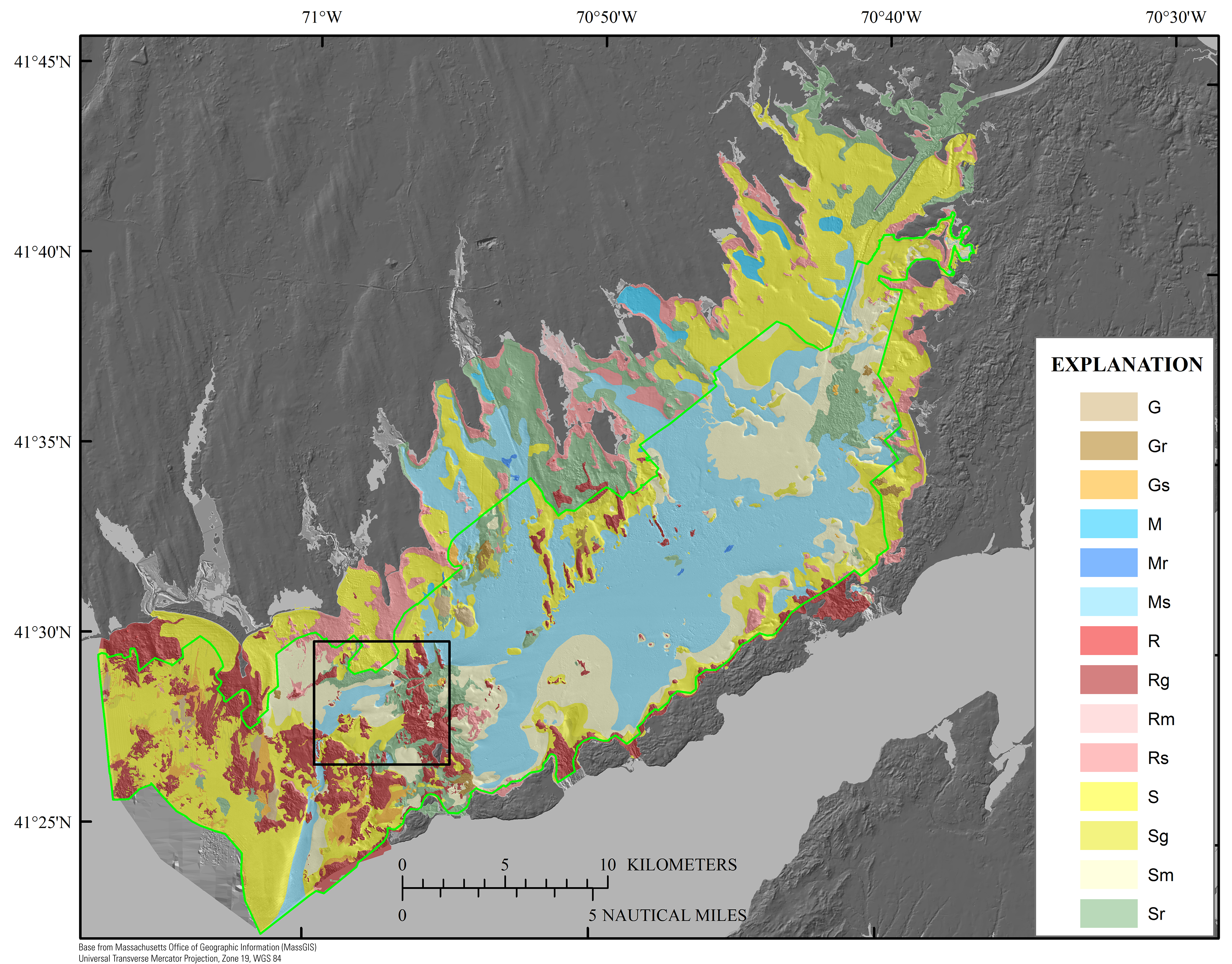
Figure 17. Map showing the distribution of sediment textures within the Buzzards Bay study area on the basis of the bottom-type classification from Barnhardt and others (1998) (fig. 6). The green polygon denotes higher confidence levels (fig. 8;table 2) inside the green line and lower confidence levels outside the green line. The black rectangle indicates the location of figure 18. The bathymetry hillshade relief map underlying the sediment texture layer is modified from the composite bathymetry of Buzzards Bay (fig. 3).
|