Open-File Report 2014-1220
>> Pubs Warehouse > OF 2014-1220
Shallow Geology, Sea-Floor Texture, and Physiographic Zones of Buzzards Bay, Massachusetts
 |
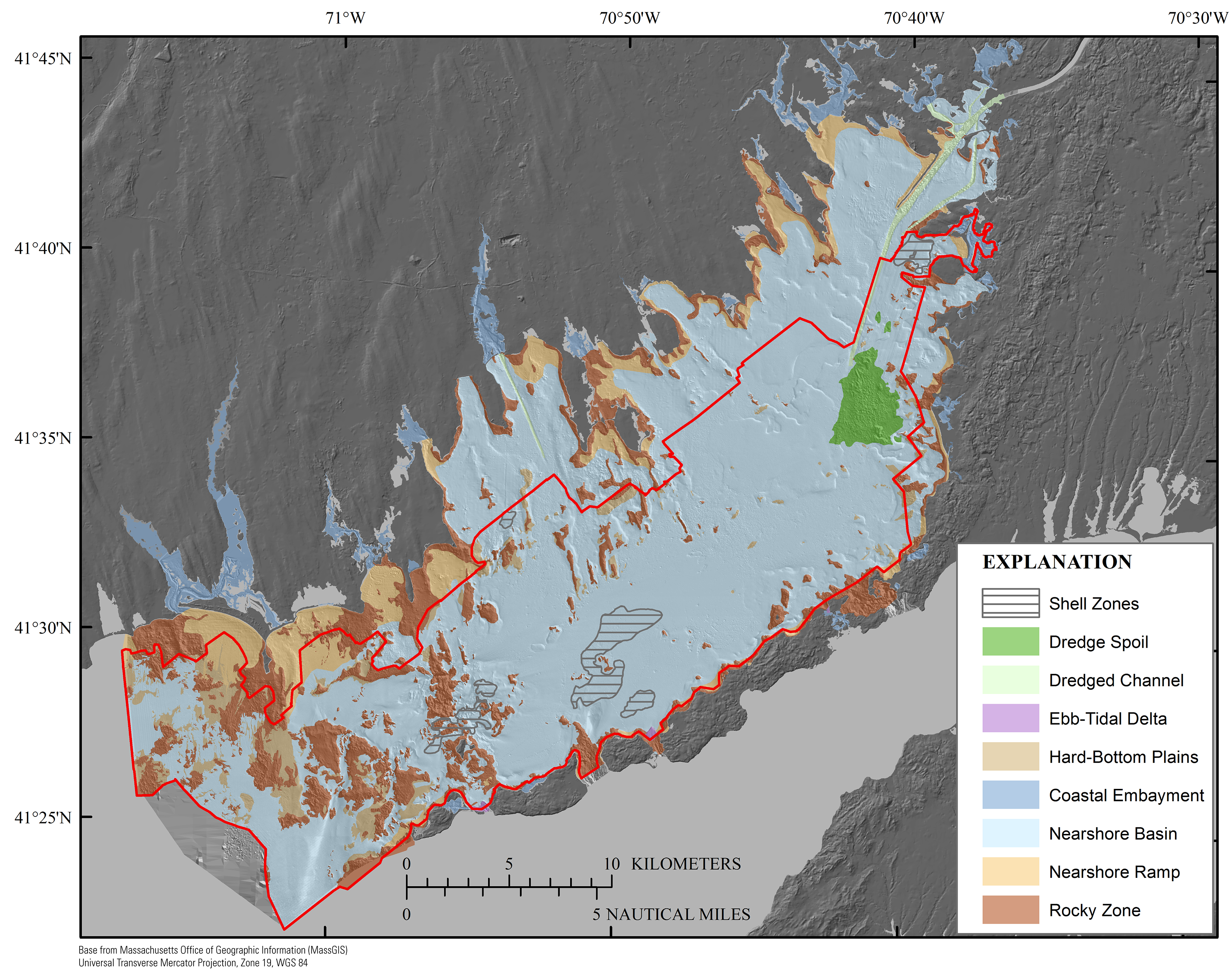
Figure 19. Map showing the distribution of physiographic zones within the Buzzards Bay study area. The physiographic zone classification is adapted from Kelley and others (1998), and the zones are delineated on the basis of sea-floor morphology and the dominant texture of surficial material. The red polygon denotes higher confidence levels (fig. 8; table 2) inside the line and lower confidence levels outside the line. The bathymetry hillshade relief map underlying the physiographic zone layer is modified from the composite bathymetry of Buzzards Bay (fig. 3).
|