Appendix 1 – Geospatial Data
This section describes the data collected for this project, the location of the data, and how to access them.
Data Format and Projection
Most vector data are delivered as Esri shapefiles in the World Geodetic System of 1984 (WGS 84) geographic coordinate system.
All spatial data are distributed with Esri-style metadata in extensible markup language (XML) format. Metadata are also provided for all spatial data in Federal Geographic Data Committee (FGDC) compliant text (TXT) and FGDC classic hypertext markup language (HTML) formats. Esri ArcCatalog 9.x can be used to examine the metadata in a variety of additional formats.
Data Access
The complete datasets from this project can be accessed in the following ways:
- With ArcGIS 9.2 or later, all shapefile and raster data can be viewed and manipulated. Download the shapefiles and organize them into the directory structure outlined below, then open the ArcMap document 2014_1221.mxd. This map document has all the data layers loaded in the table of contents and uses relative links for access to the data and hotlinked sea-floor photographs.
- Without any geographic information systems (GIS) software, view the data through ArcReader, a free mapping application distributed by Esri for Windows, Linux, and Unix operating systems. Download ArcReader from the Esri Web site (http://www.esri.com/software/arcgis/arcreader/download.html) and follow the directions for downloading and installing the free software. Once ArcReader is installed, all the data can be viewed by opening the published map file (PMF) named 2014_1221.pmf, which was created in ArcMap version 9.3.1.
Data Organization
The data are organized in folders on the Publications Warehouse Web site. Data layers can be downloaded individually using the table below. Individual layers are provided in compressed (ZIP) files. Files in a ZIP archive can be extracted with various free software that can be found online.
 GIS—Top-level directory for all spatial data. Download the files to this folder on a local hard drive. Note: The size of the uncompressed GIS directory on the DVD-ROM is approximately 8.24 gigabytes (GB) GIS—Top-level directory for all spatial data. Download the files to this folder on a local hard drive. Note: The size of the uncompressed GIS directory on the DVD-ROM is approximately 8.24 gigabytes (GB)
2014_1221.mxd—ArcGIS 9.3 map document (created with Esri ArcGIS 10.1) with all data loaded in the ArcMap table of contents
2014_1221. pmf—Esri ArcReader map document (created with Esri ArcGIS 9.3 Publisher) for use with free ArcReader software. Download ArcReader at http://www.esri.com/software/arcgis/arcreader/download.html
hyperlink_images—Folder containing sea-floor photographs in JPEG format. The sea-floor photographs are hyperlinked to the BBVS_BottomPhotos_wBio layer in the ArcMap document (MXD) table of contents. Use the hyperlink tool in ArcGIS to click on these point locations and view the linked image (this should work flawlessly if the entire contents of the GIS directory are organized according to the directory structure outlined in this appendix and if the sea-floor photographs are downloaded as described below)
shapefile—Folder containing shapefiles in geographic coordinate system WGS 84
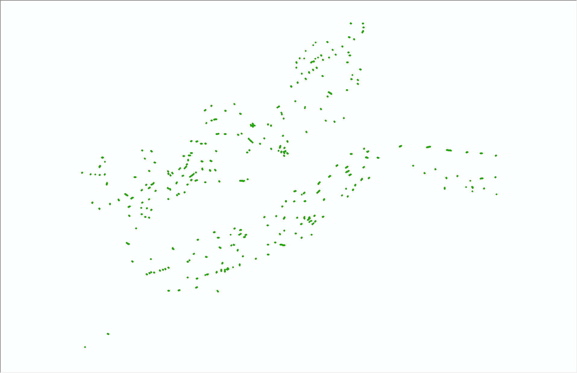
BBVS_BottomPhotos_wBio.shp—Shapefile: Sea-floor photograph locations with biological classifications
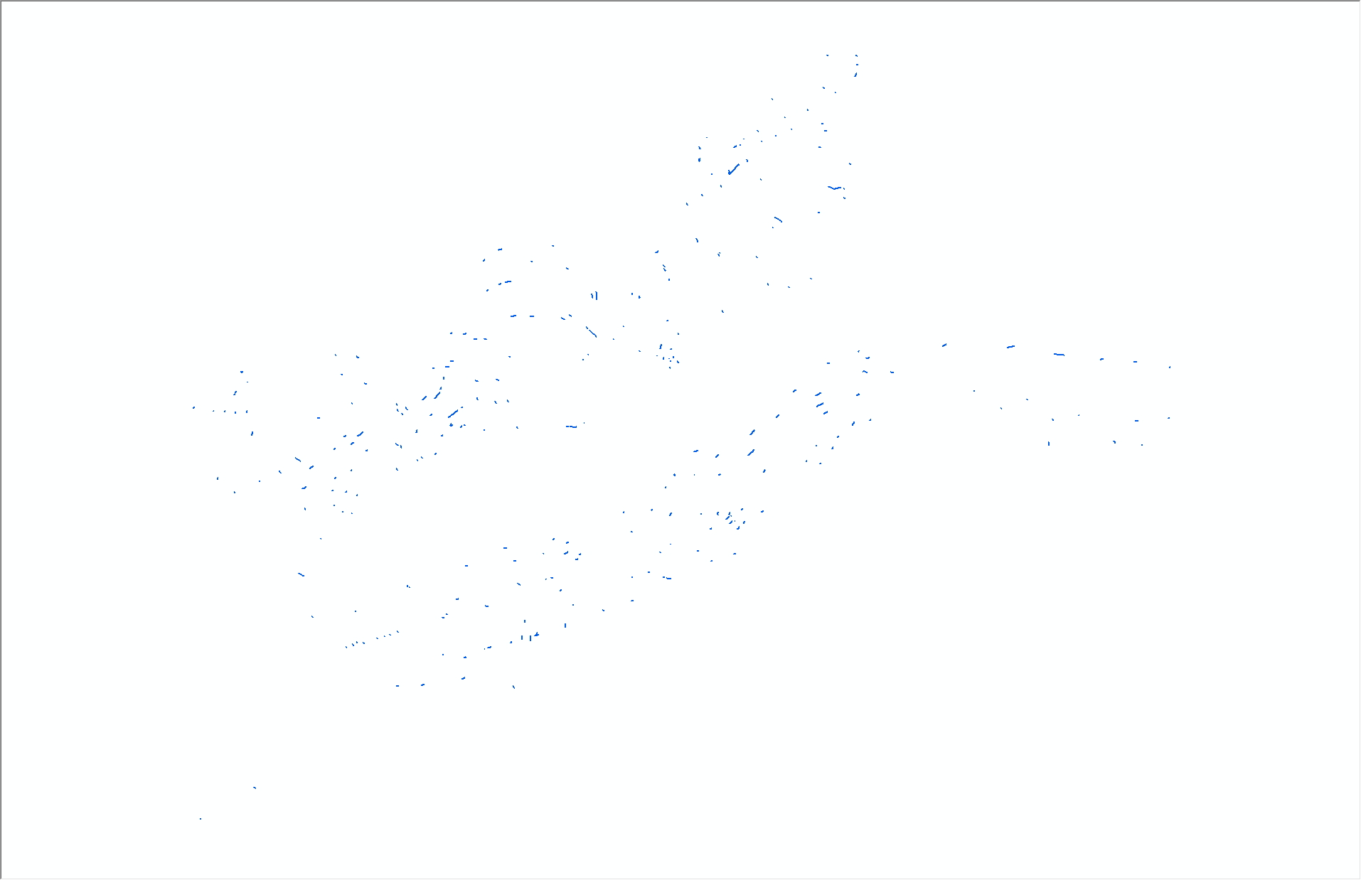
BBVS_SeabossTrackline.shp—Shapefile: Tracklines along which sea-floor photographs and videos were acquired
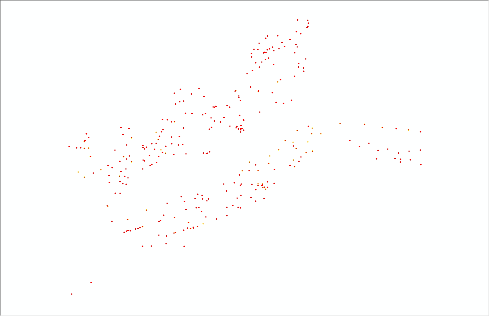
BBVS_SedimentSamples.shp—Shapefile: Locations of sediment samples or visual description of the sea floor from real-time observations. Analyses from the USGS sediment laboratory are included in this shapefile for SEABOSS stations where physical samples were collected
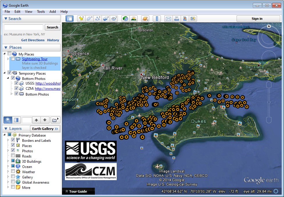
kmz—Folder containing KMZ files for viewing the bottom photographs with biological classification data in Google Earth (http://earth.google.com/)
BBVS_KMZ_BottomPhotos_wBio.kmz—Google Earth KMZ file: Sea-floor photograph locations with biological classifications
BBVS_KMZ_BottomPhotos_wBio_AttachedFauna.kmz—Google Earth KMZ file: Sea-floor photograph locations with biological classifications—subset containing only locations where BIO_SUBCL = ‘Attached Fauna’
navigation—Folder containing compressed (ZIP) navigation files from U.S. Geological Survey (USGS) survey 2010–005–FA and a script to parse the data
browse-jpg.—Folder containing the browse graphics for the GIS data catalog table below.
Data Catalog
Vector Data—The vector data are stored and delivered in shapefile format in geographic coordinates. The hyperlinks in the “Layer (metadata)” column are linked to the metadata for the shapefile. The link in the “Download” column provides access to a compressed ZIP file, which contains the shapefile and csv, if applicable. The KMZ file for the bottom photographs must be downloaded separately from the shapefile and metadata.
Layer (metadata) |
Description |
Preview |
Download file
(size) |
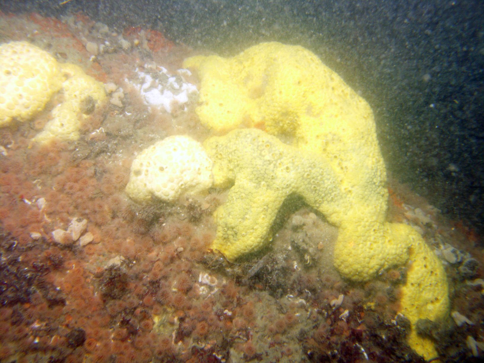
BBVS_BottomPhotos_wBio |
Sea-floor photograph locations with biological classifications |

|
Shapefile
(<1 MB)
|
BBVS_SeabossTrackline |
Tracklines along which sea-floor photographs and videos were acquired |

|
Shapefile
(<1 MB) |
BBVS_SedimentSamples |
Locations of sediment samples or visual description of the sea floor from real-time observations.
Analyses from the USGS sediment laboratory are included in this shapefile for SEABOSS stations where physical samples were collected |

|
Shapefile
(<1 MB) |
KMZ Data—These data are stored and delivered in Google Earth KMZ format. The hyperlinks in the “Layer (metadata)” column are linked to the metadata for the KMZ files. The link in the “Download” column provides access to a compressed ZIP file, which contains the KMZ files and metadata.
Image Data—To download these photographs in bulk (note: this could take a very long time), users can use the “wget” command in a Windows command prompt or terminal program in Linux, Unix, or Mac OS X operating systems. Change directory (“cd”) into the “GIS/hyperlink_images/seaboss/10005/” folder (following the directory structure outlined above in “Data Organization”). Then run the following command:
wget -r -l1 -H -t1 -nd -N -np -A.JPG -erobots=off https://pubs.usgs.gov/of/2014/1221/GIS/hyperlink_images/seaboss/10005/
Hyperlinked Images
(metadata) |
Description |
Preview |
Download file (size) |
| BBVS_SEABOSS_Photos |
Sea-floor photographs in JPEG format |

|
** See note above for downloading instructions
(8.21 GB) |
Navigation Data—The link in the “Download” column provides access to a compressed ZIP file, which contains the navigation files.
|