Open-File Report 2014-1224
![]() Title |
List of Figures |
Conversion Factors |
Abstract |
Introduction |
Setting |
Methods |
Bathymetry |
Sidescan Sonar |
Sediments |
Bottom Photography |
Interpretation |
GIS Data Catalog |
Summary |
Acknowledgments |
References |
Contacts |
Index
Title |
List of Figures |
Conversion Factors |
Abstract |
Introduction |
Setting |
Methods |
Bathymetry |
Sidescan Sonar |
Sediments |
Bottom Photography |
Interpretation |
GIS Data Catalog |
Summary |
Acknowledgments |
References |
Contacts |
Index
 |
||
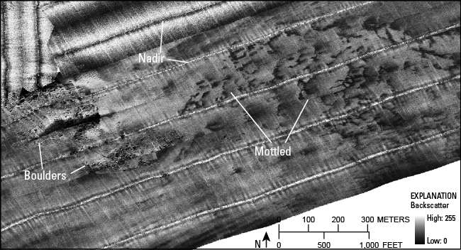
Figure 20. Detailed image of boulders and mottled areas in sidescan-sonar data. Boulders appear as high-backscatter (light tones) targets with low-backscatter (dark tones) shadows. Mottled areas are patches of high and low backscatter reflecting a hummocky sea floor and possible differences in sediment texture. In each line, the nadir, or area directly under the launch when data are collected, is also visible. Location of image is shown in figure 13. |
||