Open-File Report 2015-1149
![]() Title |
List of Figures |
Conversion Factors |
Abstract |
Introduction |
Setting |
Methods |
Bathymetry |
Sediments |
Bottom Photography |
GIS Data Catalog |
Summary |
Acknowledgments |
References |
Contacts
| Citation Page
Title |
List of Figures |
Conversion Factors |
Abstract |
Introduction |
Setting |
Methods |
Bathymetry |
Sediments |
Bottom Photography |
GIS Data Catalog |
Summary |
Acknowledgments |
References |
Contacts
| Citation Page
 |
||
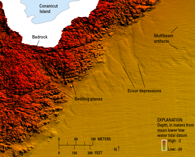
Figure 11. Detailed bathymetric image of scour depressions south of Conanicut Island and exposed bedrock near the coast. Scour depressions are aligned perpendicular to the coast. Bedding planes in the bedrock are visible. Artifacts in the multibeam bathymetry are present. Location of image is shown in figure 9. |
||

![]() U.S. Department of the Interior |
U.S. Geological Survey
U.S. Department of the Interior |
U.S. Geological Survey
URL: http://pubsdata.usgs.gov/pubs/of/2015/1149/html/ofr20151149_fig11.html
Page Contact Information: GS Pubs Web Contact
Page Last Modified: Wednesday, 07-Dec-2016 21:44:01 EST
