Open-File Report 2015-1149
![]() Title |
List of Figures |
Conversion Factors |
Abstract |
Introduction |
Setting |
Methods |
Bathymetry |
Sediments |
Bottom Photography |
GIS Data Catalog |
Summary |
Acknowledgments |
References |
Contacts
| Citation Page
Title |
List of Figures |
Conversion Factors |
Abstract |
Introduction |
Setting |
Methods |
Bathymetry |
Sediments |
Bottom Photography |
GIS Data Catalog |
Summary |
Acknowledgments |
References |
Contacts
| Citation Page
 |
||
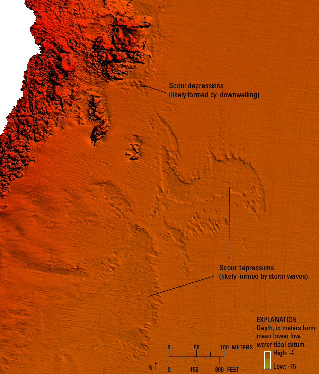
Figure 12. Detailed bathymetric image of scour depressions in West Passage. Those located adjacent to the shoreline and submerged bedrock were likely formed by downwelling of return flow from storm waves, while those further from the shore were likely scoured by storm-wave-induced currents. Location of image is shown in figure 9. |
||

![]() U.S. Department of the Interior |
U.S. Geological Survey
U.S. Department of the Interior |
U.S. Geological Survey
URL: http://pubsdata.usgs.gov/pubs/of/2015/1149/html/ofr20151149_fig12.html
Page Contact Information: GS Pubs Web Contact
Page Last Modified: Wednesday, 07-Dec-2016 21:44:01 EST
