Open-File Report 2015-1149
![]() Title |
List of Figures |
Conversion Factors |
Abstract |
Introduction |
Setting |
Methods |
Bathymetry |
Sediments |
Bottom Photography |
GIS Data Catalog |
Summary |
Acknowledgments |
References |
Contacts
| Citation Page
Title |
List of Figures |
Conversion Factors |
Abstract |
Introduction |
Setting |
Methods |
Bathymetry |
Sediments |
Bottom Photography |
GIS Data Catalog |
Summary |
Acknowledgments |
References |
Contacts
| Citation Page
 |
||
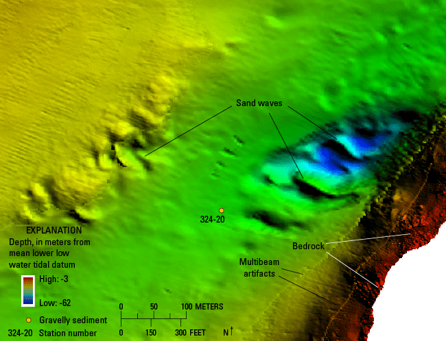
Figure 13. Detailed bathymetric image of sand waves located in the deep channel west of Aquidneck Island. Sand-wave profiles are nearly symmetrical indicating that there is no dominant direction of net sediment transport. Bedrock is present along the eastern side of the image. Site of gravelly sediment obtained at station 324-20 is also displayed. Artifacts in the multibeam bathymetry are present. Location of image is shown in figure 9. |
||

![]() U.S. Department of the Interior |
U.S. Geological Survey
U.S. Department of the Interior |
U.S. Geological Survey
URL: http://pubsdata.usgs.gov/pubs/of/2015/1149/html/ofr20151149_fig13.html
Page Contact Information: GS Pubs Web Contact
Page Last Modified: Wednesday, 07-Dec-2016 21:44:02 EST
