
Multibeam Sonar Mapping and Modeling of a Submerged Bryophyte Mat in Crater Lake, Oregon
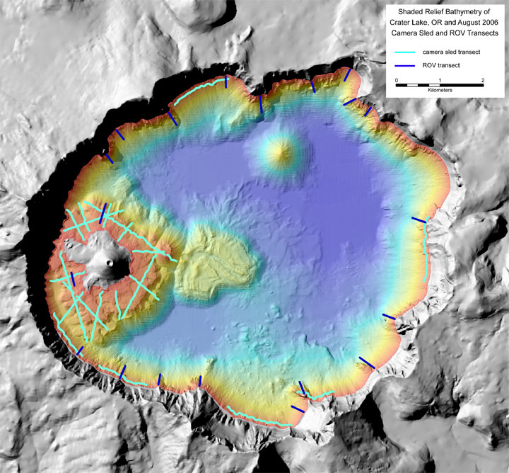
Figure 3. Shaded-relief bathymetry image of Crater Lake, Oregon. The colored region is the lake floor, and the gray region is the surrounding mountains and Wizard Island. The width of the lake is about 9 km (5.6 mi). The reds and yellows show the shallower depths of the lake, whereas the greens and blues show the deeper areas. The gray land area is generated from U.S. Geological Survey 7.5-minute digital elevation models (DEM's). Crater Lake occupies a caldera in Mount Mazama, a Cascade Range volcano that once stood about 3,700 m (12,000 ft) high. Mount Mazama erupted about 7,700 years ago and soon after collapsed upon itself to form the caldera shown in this view. This image also shows the August 2006 camera sled (light blue) and ROV (dark blue) transects used to ground-truth the moss-distribution model in this report.
For more information contact: Peter Dartnell
