USGS - science for a changing world

Data Series 366

Multibeam Sonar Mapping and Modeling of a Submerged Bryophyte Mat in Crater Lake, Oregon
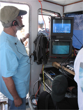
Figure 6. Summer 2006 Camera Sled Operations within Crater Lake, Oregon

Figure 6. Camera sled operations during the summer 2006 ground-truthing cruise. This photograph shows the real-time video feed to the RV Neuston that is used to fly the sled and to make real-time lake floor observations (Robert Collier, OSU in photo).

For more information contact: Peter Dartnell

Accessibility FOIA Privacy Policies and Notices

Take Pride in America logo USA.gov logo U.S. Department of the Interior | U.S. Geological Survey
URL: https://pubs.usgs.gov/ds/366/figure6.html
Page Contact Information: Michael Diggles
Page Last Modified: August 19, 2008 (P.D.)