USGS - science for a changing world

Data Series 366

Multibeam Sonar Mapping and Modeling of a Submerged Bryophyte Mat in Crater Lake, Oregon

Figure 8. Coverage of Moss Over Wizard Island Platform, Crater Lake, Oregon

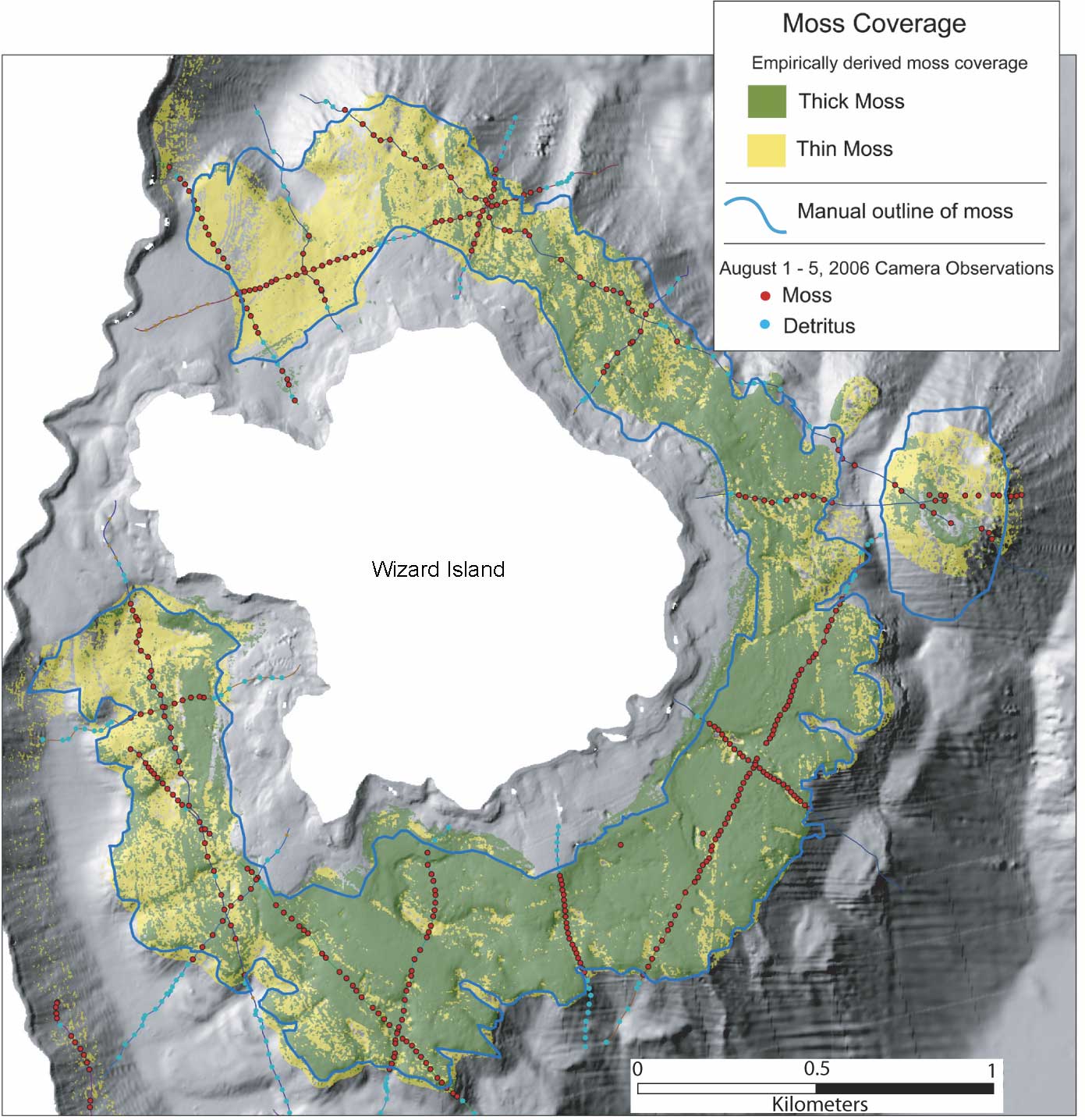
Figure 8. Map showing the distribution of "continuous" or thick and "patchy" or thin moss over the Wizard Island platform.

For more information contact: Peter Dartnell

Accessibility FOIA Privacy Policies and Notices

Take Pride in America logo USA.gov logo U.S. Department of the Interior | U.S. Geological Survey
URL: https://pubs.usgs.gov/ds/366/figure8.html
Page Contact Information: Michael Diggles
Page Last Modified: August 19, 2008 (P.D.)