
Multibeam Sonar Mapping and Modeling of a Submerged Bryophyte Mat in Crater Lake, Oregon
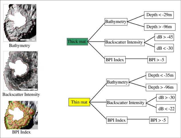
Figure 7. Moss-distribution model or decision-tree mapping the distribution of "thick" and "thin" mat of moss in Crater Lake. The model is built in ERDAS Imagine software. Any use of trade, firm, or product names in this publication is for descriptive purposes only and does not imply endorsement by the U.S. government.
For more information contact: Peter Dartnell
