U.S. Geological Survey Open-File Report 2009-1001
Geological Interpretation of the Sea Floor Offshore of Edgartown, Massachusetts
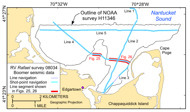 |
Figure 12. The locations of the tracklines (blue lines) along which the 5 Boomer high-resolution seismic-reflection profiles were collected during cruise 08034 of research vessel Rafael. Also shown are the locations of profile segments shown in figures 25 and 26 (red segments). |

![]() U.S. Department of the Interior |
U.S. Geological Survey
U.S. Department of the Interior |
U.S. Geological Survey
URL: https://pubsdata.usgs.gov/pubs/of/2009/1001/html/fig12.html
Page Contact Information: Contact USGS
Page Last Modified: Wednesday, 07-Dec-2016 22:23:00 EST

