U.S. Geological Survey Open-File Report 2009-1001
Geological Interpretation of the Sea Floor Offshore of Edgartown, Massachusetts
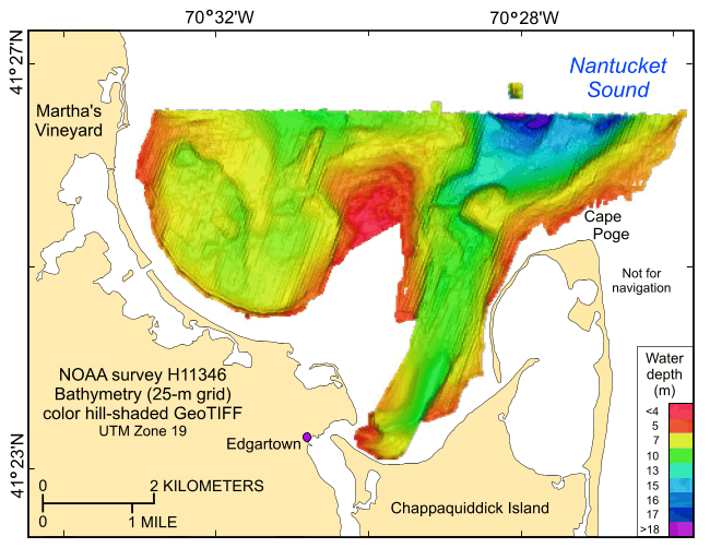 |
Figure 19. Digital terrain model of the sea floor produced from the single-beam and multibeam bathymetry collected during National Oceanic and Atmospheric Administration survey H11346 and gridded to 25 m. Image is sun-illuminated from 46° and vertically exaggerated 10X. Hotter colors are shallower areas; cooler colors are deeper areas. See key for depth ranges. |

![]() U.S. Department of the Interior |
U.S. Geological Survey
U.S. Department of the Interior |
U.S. Geological Survey
URL: https://pubsdata.usgs.gov/pubs/of/2009/1001/html/fig19.html
Page Contact Information: Contact USGS
Page Last Modified: Wednesday, 07-Dec-2016 22:23:04 EST

