U.S. Geological Survey Open-File Report 2009-1001
Geological Interpretation of the Sea Floor Offshore of Edgartown, Massachusetts
 |
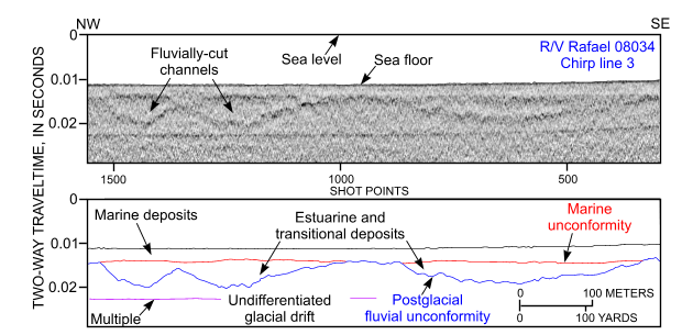
Figure 27. Segment of Chirp high-resolution seismic-reflection profile and interpretation from research vessel Rafael cruise 08034 line 3 offshore of Edgartown Beach. The surface of the glacial drift has been fluvially eroded, and topographic lows have been filled by estuarine and transitional deposits. Location of profile is shown in figure 13. |