U.S. Geological Survey Open-File Report 2009-1001
Geological Interpretation of the Sea Floor Offshore of Edgartown, Massachusetts
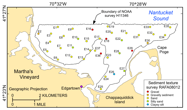 |
Figure 29. Locations of stations at which sediment samples were collected during cruise 08034 of research vessel Rafael to verify acoustic data. Hotter colors are coarser grained sediment; cooler colors are finer grained sediments. See key for sediment classifications. |

![]() U.S. Department of the Interior |
U.S. Geological Survey
U.S. Department of the Interior |
U.S. Geological Survey
URL: https://pubsdata.usgs.gov/pubs/of/2009/1001/html/fig29.html
Page Contact Information: Contact USGS
Page Last Modified: Wednesday, 07-Dec-2016 22:23:10 EST

