Firn
An intermediate stage in the transformation of snow to glacier
ice. Snow becomes firn when it has been compressed so that
no pore space remains between flakes or crystals, a process
that takes less than a year.
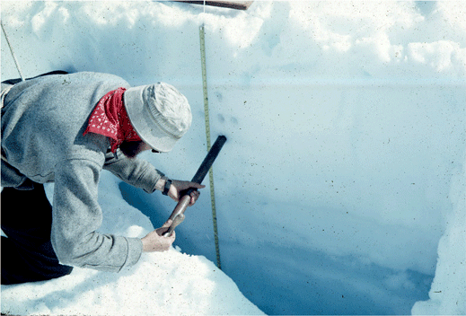
Photograph showing a scientist collecting snow
and ice samples from the wall of a snow pit. Fresh
snow can be seen at the surface and glacier ice
at the bottom of the pit wall. The snow layers
are composed of progressively denser firn. Taku
Glacier, Juneau Icefield, Tongass National Forest,
Alaska. |
|
|
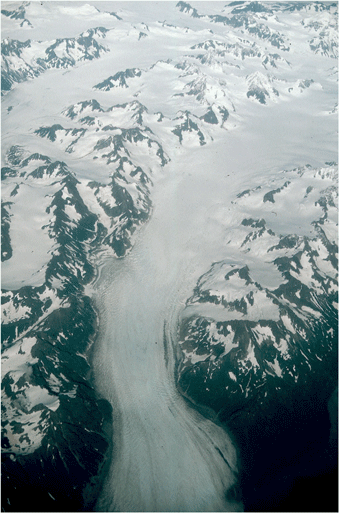
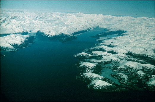
Oblique aerial photograph of the lower reaches of
an unnamed Alaskan valley glacier, located east
of Yakutat Bay, St Elias Mountains, Tongass National
Forest, Alaska. The transition from bare glacier
ice to snow-covered glacier is subtle. It can be
found by noting the appearance of medial moraines. |
Firn line
A line across the glacier, from edge to edge, that marks
the transition between exposed glacier ice (below) and the
snow-covered surface of a glacier (right). During the summer
melt season, this line migrates up-glacier. At the end of
the melt season the firn line separates the accumulation
zone from the ablation zone.
|
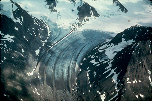
North-looking oblique aerial photograph of the lower
reaches of an unnamed Alaskan valley glacier, informally
known as Five Stripe Glacier, showing the abrupt
transition from bare, blue glacier ice to snow-covered
glacier. This is the firn line. Also show are lateral
and medial moraines, trimlines, outwash sediment
and many other related glacial features, Chugach
Mountains, Alaska. |
|
|
Fjord
A glacially eroded or modified U-shaped valley that extends
below sea level and connects to the ocean. Filled with seawater,
depths may reach more than 1,000 feet below sea level. The
largest Alaskan fiords are more than 100 miles long and
more
than 5 miles wide. Also spelled Fiord.
Oblique aerial photograph of College Fiord (the
right arm) and Barry Arm, two fiords located in
western Prince William Sound, Chugach National
forest, Chugach mountains, Alaska. |
|
|
Photograph of the terminus of Lamplugh Glacier,
Glacier Bay National Park, Alaska, showing numerous
folia exposed in cross-section. Note the complex
character of the folia, especially their intersecting
and truncated character. The field of view from
top to bottom is ~ 200 ft. |
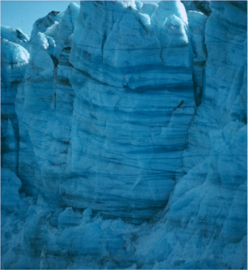
Foliation
The layering or banding that develops in a glacier during
the process of transformation of snow to glacier ice. Individual
layers, called folia, are visible because of differences in
crystal or grain size, alternation of clear ice and bubbly
ice, or because of entrained sediment.
|

East-looking oblique aerial photograph of the middle
reaches of Sherman Glacier, an Alaskan valley glacier,
located east of Cordova. Folding, and subsequent
melting of the glacier has revealed a nested stratigaphy
of concentric folia, Chugach National Forest, Chugach
Mountains, Alaska. |
|
|
Fountain
A glacial spring, generally discharging supercooled water
with a significant hydrostatic head.
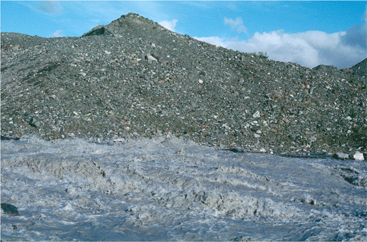
North-looking photograph of a large fountain composed
of rock-flour-rich, cold glacial meltwater. The
fountain is bubbling to the surface of an unnamed
ice-marginal stream adjacent to the debris-covered
western terminus of Malaspina Glacier, St Elias
Mountains, Wrangell-St. Elias National Park, Alaska. |
|
|
|