This quarter mile-long mass of glacier ice, formerly
a part of Guyot Glacier, is rapidly melting away
in Wrangell-St.Elias National Park, Alaska. |
Remnant
An isolated melting mass of glacier ice, that has become
detached from its source and the remainder of the glacier.
Some remnants cover many square miles.
|
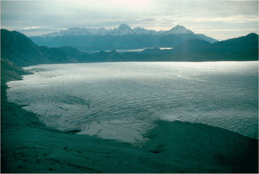
This large mass of ice known as the Muir Remnant was formerly connected to
the retreating Muir Glacier, in Glacier Bay National Park, Alaska.
Its maximum length was more than 2 miles. |
|
|
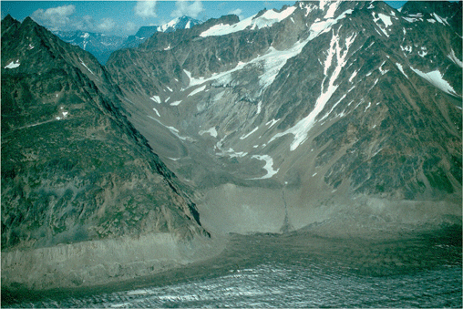
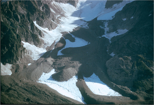
This cirque and valley was recently filled by a
much larger icemass that connected it to the surface
of the Bering Glacier, which now lies separate in
the foreground. Note the well-exposed trimline.
Bagley ice valley, Wrangell-St.Elias National Park,
Alaska. |
Retreat
A decrease in the length of a glacier compared to a previous
point in time. As ice in a glacier is always moving forward,
its terminus retreats when more ice is lost at the terminus
to melting and/or calving than reaches the terminus. During
retreat, ice in a glacier does not move back up the valley.
|

The bedrock in this photo has recently emerged from
the shrinking Mendenhall Glacier seen at the upper
left of this picture. The Mendenhall
Glacier retreats as much as 50 ft per year. Juneau Ice Field,
Tongass National Forest, Alaska. |
|
|
Roche Moutonnée
An elongated, rounded, asymmetrical, bedrock knob produced
by glacier erosion. It has a gentle slope on its up-glacier
side and a steep- to vertical-face on the down-glacier side.
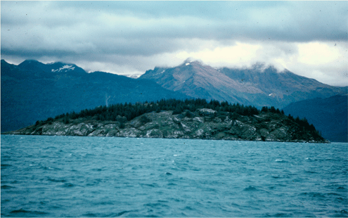
Glacier erosion has produced this streamilined
bedrock mass projecting above the waters of Glacier
Bay, Glacier Bay National Park, Alaska. |
|
|
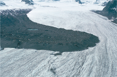
This large landslide covered more than half the
width of Allen Glacier, Chugach Mountains, Alaska. |
Rockslide
A mass of unsorted, generally angular rock material that
has fallen from the adjacent wall of the bedrock valley onto
the surface of a glacier. Many rockslides are triggered by
seismic activity.
|
Several landslides generated by the Great Alaskan
Earthquake, Good Friday 1964, fell onto the surface
of the so-named glacierin the Chugach Mountains,
Alaska. |
|
|
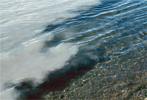
Rock flour is seen mixing with sedmient-free water
at the confluence of a glacial and non-glacial stream
in Denali National Park, Alaska. |
Rock Flour
Fine-grained, silt-size sediment formed by the mechanical
erosion of bedrock at the base and sides of a glacier
by moving ice. When it enters a stream, it turns the
stream's color brown, gray, iridescent blue-green, or
milky white. Also called Glacier Flour or Glacier
Milk.
|
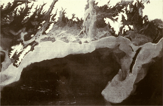
LANDSAT MSS satellite image showing large quantities
of suspended sediment, composed of rock flour, in
the Gulf of Alaska south of the Copper River, Alaska. |
|
|
|