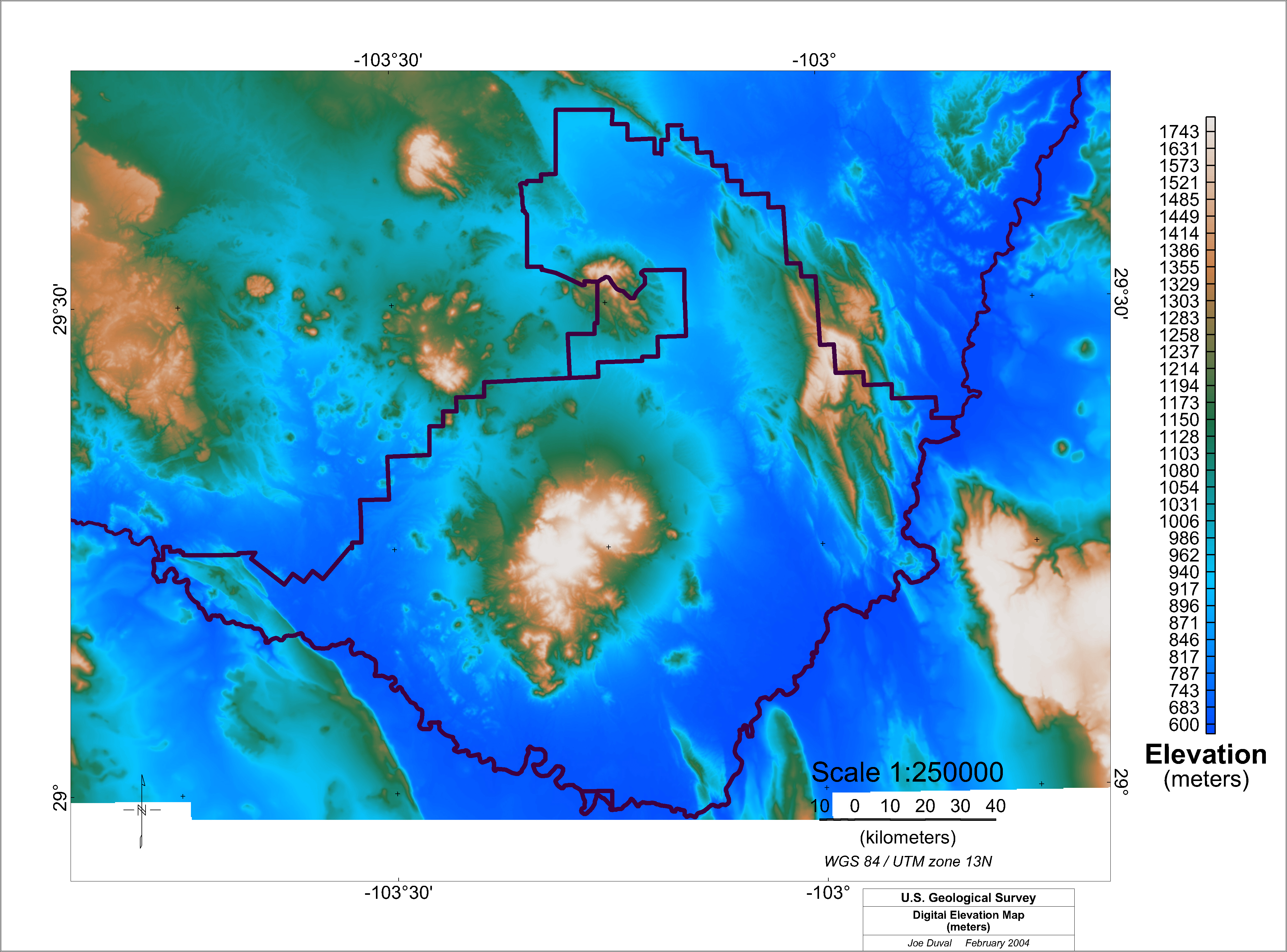
Figure 10. Digital elevation of Big Bend study area. Dark lines on the map mark the boundaries of the Big Bend National Park and the Rio Grande River. Digital elevation data were obtained from the U.S. Geological Survey National Elevation Dataset (NED).
K Map | U Map | Th Map | Gamma-ray Map | Landsat Visible | Landsat Red | Landsat Infrared | Landsat Color | DEM
Intro | Geology | Gamma-ray Data | Landsat Data | Discussion | Conclusions | Listing of Data Files | References | Tutorial

![]() U.S. Department of the Interior |
U.S. Geological Survey
U.S. Department of the Interior |
U.S. Geological Survey
URL: http://pubsdata.usgs.gov/pubs/of/2005/1371/html/demdata.htm
Page Contact Information: Stephen Snyder
Page Last Modified: Saturday, 12-Jan-2013 21:44:58 EST