USGS Open-File Report 2005-1371
By Joseph S. Duval
Geology
Gamma-ray Data
Landsat Data
Maps of Data
Potassium Map
Uranium Map
Thorium Map
Gamma-ray Color-composite Map
Landsat Visible Bands
Landsat Red Bands
Landsat Infrared Bands
Landsat Color-ratio Composite
Digital Elevation Data
Discussion
Classification of Gamma-ray Data
Subarea Index Map
Subarea 1 Discussion
Subarea 2 Discussion
Subarea 3 Discussion
Conclusions
Listing of Data Files
References
Tutorial
Tutorial0
Tutorial1
Tutorial2
Tutorial3
Tutorial4
Tutorial5
Tutorial6
Tutorial7
Tutorial8
Tutorial9
Tutorial10
Note on Data Availability
The file named "BigBend.exe" is a self-extracting file (441 megabytes) that will extract installation files for the data and maps associated with the report. Double click on the file and then extract the installation files to a temporary directory of your choice. After you have extracted the files, navigate to that directory and double click on the file named "setup.exe". Follow the instructions and the files will be placed in a directory (you can choose where) on your hard disk. The report provides information about the data and maps as well as a free viewer program that you will need to install.
A copy of the CD-ROM can be obtained by contacting the U.S. Geological Survey at
USGS Information Services
Box 25286
Denver CO 80225
You can also call 1-888-ASK-USGS (1-888-275-8747) or contact Ask USGS.
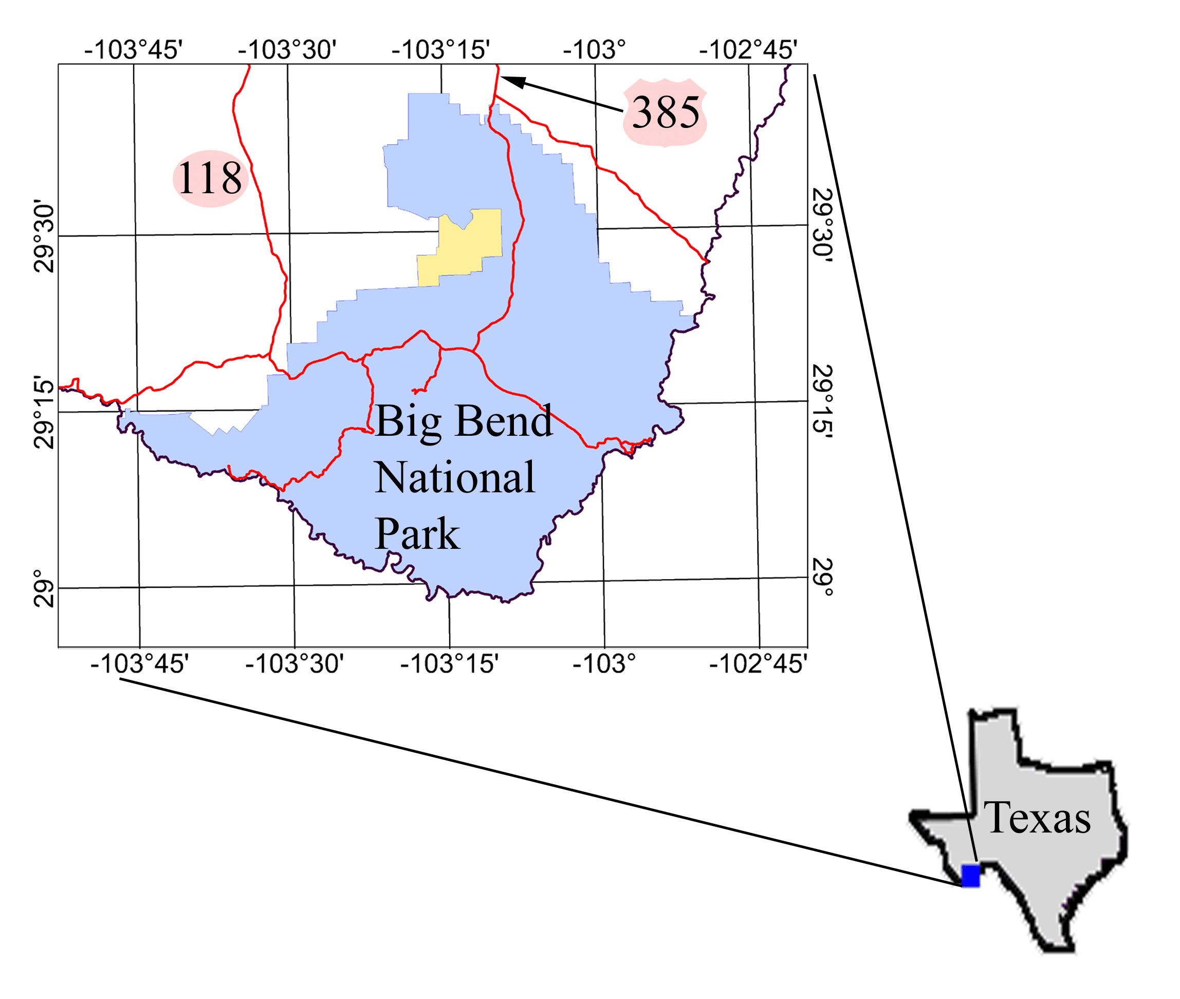
This report presents the results of analyses and interpretation of aerial gamma-ray, Landsat TM, geologic, and digital elevation data of the Big Bend area in Texas. Figure 1 shows an index map of the study area. The gamma-ray data include data obtained as part of the National Uranium Resource Evaluation (NURE) Program of the U.S. Department of Energy during the period 1975 - 1983 and data obtained under contract to the U.S. Geological Survey (USGS) in 2003. The NURE surveys used were for the Emory Peak Quadrangle and detailed surveys of Christmas Mountains, El Solitario, and Green Valley areas. The original NURE data have been published on CD-ROM by Duval (1999). The USGS survey was flown by Sander Geophysics Limited (SGL) and the data are available on a CD-ROM available for purchase (contact 1-888-ASK-USGS (1-888-275-8747) and refer to Open-File Report 2005-1371). Refer to the section on gamma-ray data for more information about these surveys. The USGS has a project active from 2003 - 2007 to produce a modern geologic map of the Big Bend National Park.

Figure 1. Index map of Big Bend study area. The area in yellow is Rosillos Ranch which is private land.
Aerial gamma-ray surveys measure gamma rays emitted by naturally occurring radioactive isotopes of the decay series of potassium (40K), uranium (238U), and thorium (232Th). The gamma rays emitted by the different isotopes have different energies and a gamma-ray spectrometer can distinguish between them. The number of gamma-rays detected is directly proportional to the concentration of the parent nuclide (assuming radioactive equilibrium). The gamma-ray can thus be used to estimate the concentrations of potassium, uranium, and thorium in the near surface soils and rocks (most of the gamma-rays detected originate in the top 30 cm of material). These estimated concentrations can in turn provide clues regarding the lithologic characteristics of the materials.
In a similar manner, Landsat satellite data measure the spectral properties of visible and near infrared light reflected or emitted by the surface materials (visible light is reflected and infrared may be both reflected and emitted light). In the absence of vegetation these data reflect the minerals present in the surface materials and also provide clues regarding the lithologic characteristics of those materials.
Digital elevation data (DEM) are a measure of the topographic characteristics of the landscape. Because the weathering properties of rocks are variable and often reflect the lithologic properties, the DEM data can be used in conjunction with other data to aid geologic mapping.
This publication was prepared by an agency of the United States Government. Neither the United States Government nor any agency thereof, nor any of their employees, makes any warranty, expressed or implied, or assumes any legal liability or responsibility for the accuracy, completeness, or usefulness of any information, apparatus, product, or process disclosed in this report, or represents that its use would not infringe privately owned rights. Reference therein to any specific commercial product, process, or service by trade name, trademark, manufacturer, or otherwise does not constitute or imply its endorsement, recommendation, or favoring by the United States Government or any agency thereof. Although data from this publication has been used by the U.S. Geological Survey, no warranty, expressed or implied, is made by the U.S. Geological Survey as to the accuracy of the data. The act of distribution shall not constitute any such warranty, and no responsibility is assumed by the U.S. Geological Survey in the use of this data.