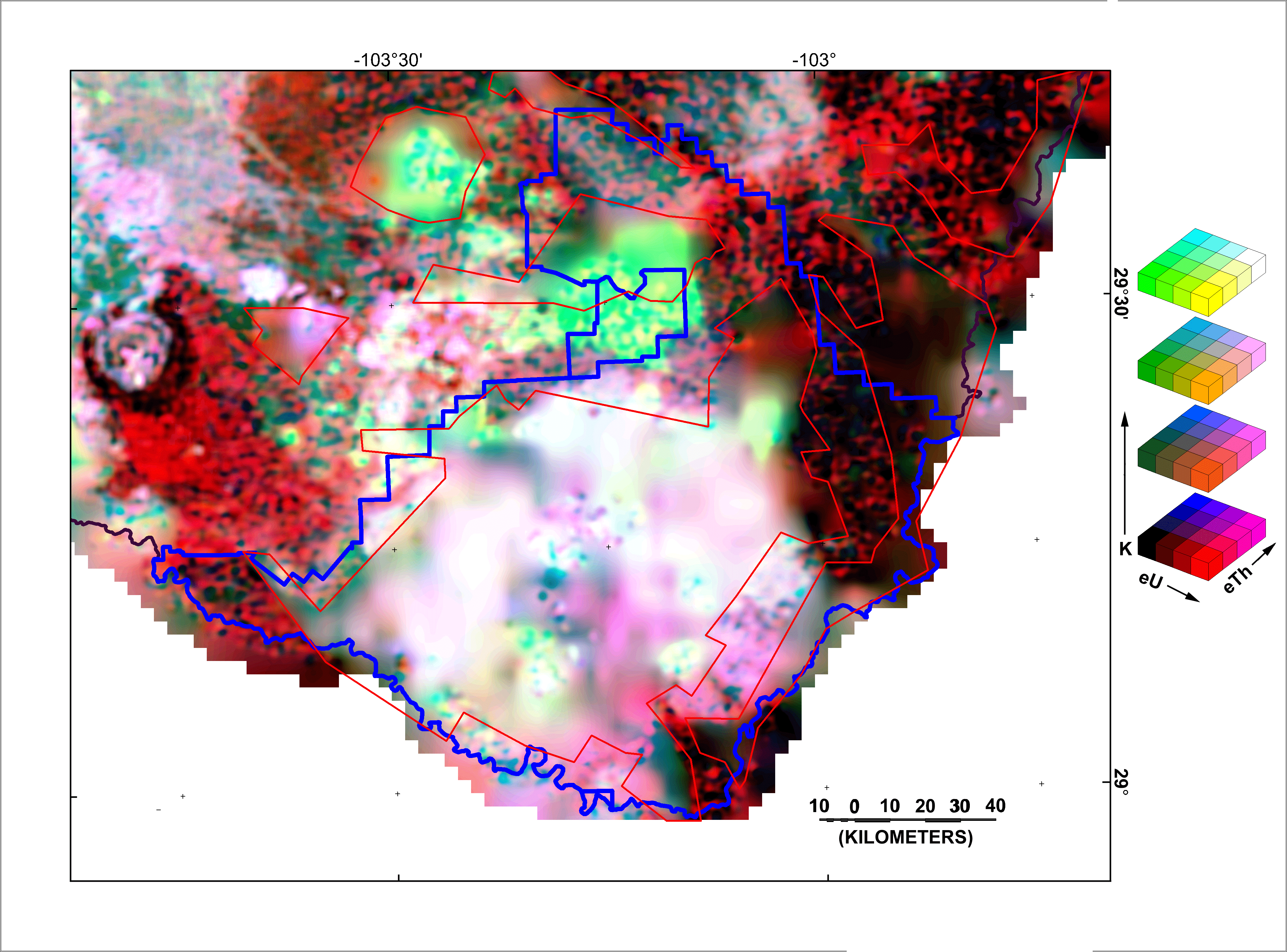
Figure 9. Gamma-ray color-composite map with potassium as shades of green, uranium as shade of red, and thorium as shades of blue. Areas with overall low radioactivity are dark (black) and areas of relatively high radioactivity are bright (white). The four-layer legend on the right illustrates how the colors change as the concentrations change. Each layer corresponds to a different concentration of potassium and the colored cubes correspond to different concentrations of uranium and thorium. The arrows indicate the directions of increasing concentrations. The blue lines on the map represent the boundaries of the Big Bend National Park, The red lines outline areas where the only significant data are the data from the NURE regional surveys. The data from the USGS detailed survey were rejected because of excessive altitudes above the ground (greater than 250 m).
K Map | U Map | Th Map | Gamma-ray Map | Landsat Visible | Landsat Red | Landsat Infrared | Landsat Color | DEM
Intro | Geology | Gamma-ray Data | Landsat Data | Discussion | Conclusions | Listing of Data Files | References | Tutorial

![]() U.S. Department of the Interior |
U.S. Geological Survey
U.S. Department of the Interior |
U.S. Geological Survey
URL: http://pubsdata.usgs.gov/pubs/of/2005/1371/html/gamccm.htm
Page Contact Information: Stephen Snyder
Page Last Modified: Saturday, 12-Jan-2013 21:45:02 EST