U.S. Geological Survey Open-File Report 2009-1001
Geological Interpretation of the Sea Floor Offshore of Edgartown, Massachusetts
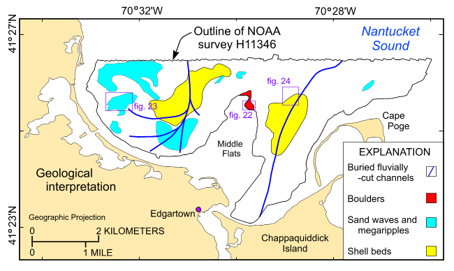 |
Figure 21. Interpretation of the sea floor surveyed in National Oceanic and Atmospheric Administration survey H11346. Interpretation includes the locations of buried fluvially cut channels; areas characterized by boulders, sand waves, and shell beds; and the locations of the detailed clips of the sidescan-sonar mosaic shown in figures 22, 23, and 24. |

![]() U.S. Department of the Interior |
U.S. Geological Survey
U.S. Department of the Interior |
U.S. Geological Survey
URL: https://pubsdata.usgs.gov/pubs/of/2009/1001/html/fig21.html
Page Contact Information: Contact USGS
Page Last Modified: Wednesday, 07-Dec-2016 22:23:06 EST

