U.S. Geological Survey Open-File Report 2009-1001
Geological Interpretation of the Sea Floor Offshore of Edgartown, Massachusetts
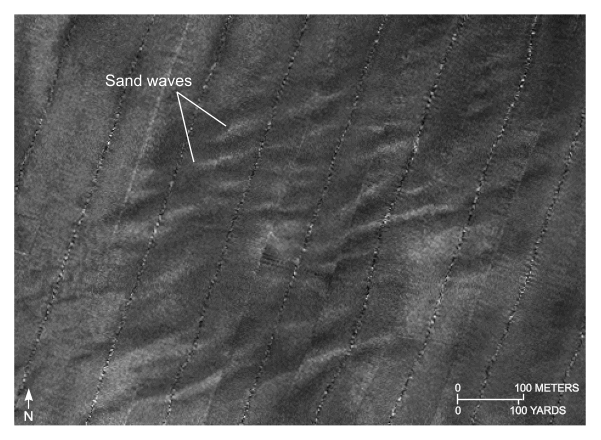 |
Figure 23. Detailed planar view of the sidescan-sonar mosaic produced during National Oceanic and Atmospheric Administration survey H11346. View shows relatively straight to sinuous alternating bands of high and low backscatter (tiger-stripe pattern) indicative of transverse sand waves. Location of view is shown in figure 21. |

![]() U.S. Department of the Interior |
U.S. Geological Survey
U.S. Department of the Interior |
U.S. Geological Survey
URL: https://pubsdata.usgs.gov/pubs/of/2009/1001/html/fig23.html
Page Contact Information: Contact USGS
Page Last Modified: Wednesday, 07-Dec-2016 22:23:07 EST

