U.S. Geological Survey Open-File Report 2009-1001
Geological Interpretation of the Sea Floor Offshore of Edgartown, Massachusetts
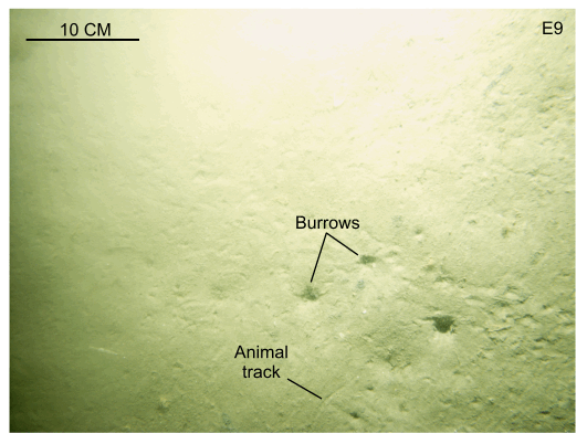 |
Figure 31. The flat, sandy bottom at station E9. This flat, sandy sea floor is typical of the deeper offshore waters in the western part of the study area. Note the presence of animal tracks and burrows. Station location is shown in figures 15 and 29. |

![]() U.S. Department of the Interior |
U.S. Geological Survey
U.S. Department of the Interior |
U.S. Geological Survey
URL: https://pubsdata.usgs.gov/pubs/of/2009/1001/html/fig31.html
Page Contact Information: Contact USGS
Page Last Modified: Wednesday, 07-Dec-2016 22:23:27 EST

