As illustrations of how the Landsat data can be combined with the gamma-ray data to provide information about some of the geologic materials, three sub-areas of the study area were selected and are discussed in some detail below. Figure 2 shows the regional geologic map with the sub-areas indicated. Click within the shaded areas to view the discussion for the sub-areas or use the table of contents.
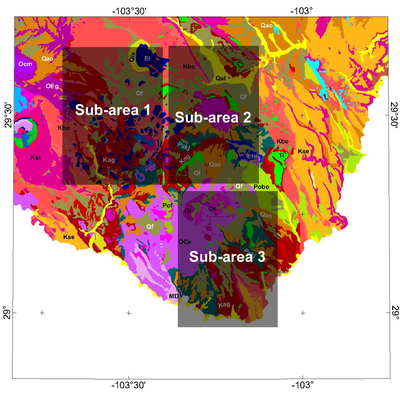
Figure 2. Sub-areas chosen for more discussion of Landsat and gamma-ray data.
Gamma-ray Data | Subarea Index | Subarea 1 | Subarea 2 | Subarea 3
Intro | Geology | Gamma-ray Data | Landsat Data | Maps | Conclusions | Listing of Data Files | References | Tutorial

![]() U.S. Department of the Interior |
U.S. Geological Survey
U.S. Department of the Interior |
U.S. Geological Survey
URL: http://pubsdata.usgs.gov/pubs/of/2005/1371/html/Subindex.htm
Page Contact Information: Stephen Snyder
Page Last Modified: Saturday, 12-Jan-2013 21:45:18 EST