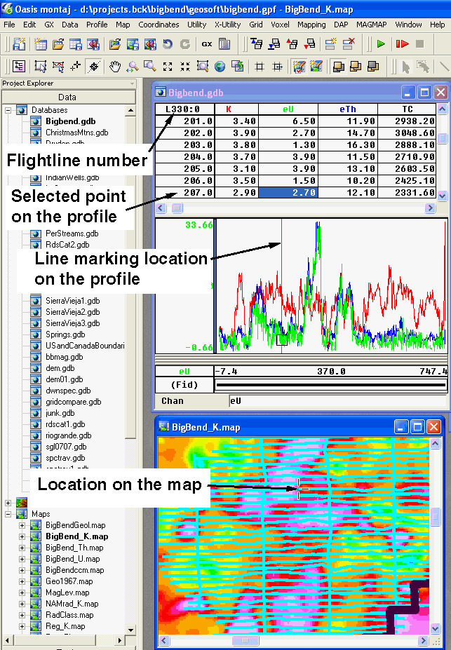
After selecting the path, you click on the flightline on the map and the data point is highlighted in the database and a corresponding cursor marks the point on the profile.

Tutorial 1 | Tutorial 2 | Tutorial 3 | Tutorial 4 | Tutorial 5 | Tutorial 6 | Tutorial 7 | Tutorial 8 | Tutorial 9 | Tutorial 10 |
Intro | Geology | Gamma-ray Data | Landsat Data | Maps | Discussion | Conclusions | Listing of Data Files | References | Tutorial