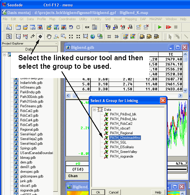
Another useful capability is that of using shadow cursors to locate a point on a map and identify that point in the database. To do so, you select the shadow cursor tool on the toolbar on the right side of the viewer window as shown in the image below. A window opens that allows you to select the path for the feature of interest. In the example shown in the image below, the profile data for the Christmas Mountains survey are to be examined.
Tutorial 1 | Tutorial 2 | Tutorial 3 | Tutorial 4 | Tutorial 5 | Tutorial 6 | Tutorial 7 | Tutorial 8 | Tutorial 9 | Tutorial 10 |
Intro | Geology | Gamma-ray Data | Landsat Data | Maps | Discussion | Conclusions | Listing of Data Files | References | Tutorial

![]() U.S. Department of the Interior |
U.S. Geological Survey
U.S. Department of the Interior |
U.S. Geological Survey
URL: http://pubsdata.usgs.gov/pubs/of/2005/1371/html/Tutorial9.htm
Page Contact Information: Stephen Snyder
Page Last Modified: Saturday, 12-Jan-2013 21:45:30 EST