|
|
The first step in locating items in the dataset is to scan the list of experiments and examine the charts to identify projects that match a geographic region of interest or a specific time. For example, if a user is researching winter storms on Georges Bank, there are three experiments that may contain measurements of interest (Georges Bank, GLOBEC Georges Bank, or GLOBEC Great South Channel). Because the GLOBEC Georges Bank experiment was carried out in summer, only the first and third are experiments of interest. Follow the links to the two pages describing the experiments and then click "Catalog of Data" to view the table of data files available. If currents in the upper 10 m of the ocean are desired, data meeting this criterion are available only in the GLOBEC Great South Channel experiment. In that experiment's table of files, 4831a-a.nc, 4831b-a.nc, 4841v-a.nc, 4901-a.nc, and 4931-a.nc may be of interest. These files can be downloaded by clicking on the filename, then choosing to "save to disk" for use with local tools.
To access the same data via OPeNDAP, return to the experiment page, then follow the "Data Access via THREDDS" link, then click on the filename selected in the directory list, then choose “OPeNDAP” from the options to display the metadata associated with the file. A text version of a variable can be displayed by clicking the box next to the variable name then pressing the "Get ASCII" button. Users may also access the OPeNDAP data directly, without downloading, using a URL of this form in their client application: (http://stellwagen.er.usgs.gov/thredds/dodsC/TSdata/{experiment}/{file_name}).
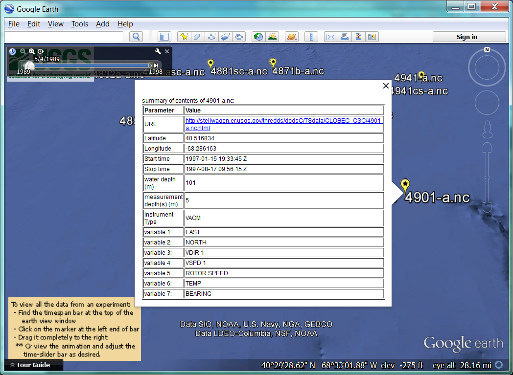
An alternate method of finding content in the database is to use the .kml file provided at the lower right of each page. After opening this file, the time slider at the top left may be used to filter the content by time. Clicking on a yellow icon that indicates the sites where data were collected displays a summary (fig. 36) of information about that file and the link to follow to access those data.
Some of the data reports may provide additional ways to locate data files of interest. For example, Butman and others (2004) provide a figure showing mooring number as a function of time and depth for the data collected in Massachusetts Bay.
 |
Figure 36. A pop-up display of metadata about sensor 4903-a.nc as accessed from the GLOBEC Great South Channel Experiment's .kml file. |
|