U.S. Geological Survey Open-File Report 2012-1178
Profile Measurements and Data From the 2011 Optics, Acoustics, and Stress In Situ (OASIS) Project at the Martha's Vineyard Coastal Observatory
/ Title Page / Acknowledgments / List of Figures / Conversion Factors / Abbreviations and Symbols / Abstract / Introduction / Site Description / Field Program / Time Line Table / Bottom Sediment Sample Table / Suspended Sediment Sample Table / Mooring Log Table / Instrumentation / Results / Digital Data File Table / References / Appendix 1 / Appendix 2 / Appendix 3 / Appendix 4 /
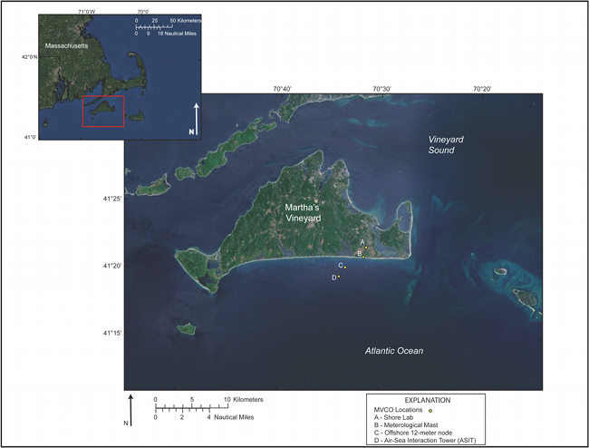
Figure 1. Satellite photograph of Martha's Vineyard and Cape Cod (inset), Massachusetts. Study site is indicated by "C" and is 2 kilometers offshore, to the south of Martha's Vineyard.
Download the full size image in PDF format.
To view files in PDF format, download a free copy of Adobe Reader.