Skip past header information
USGS - science for a changing world

U.S. Geological Survey Open-File Report 2012-1178

Profile Measurements and Data From the 2011 Optics, Acoustics, and Stress In Situ (OASIS) Project at the Martha's Vineyard Coastal Observatory


Skip past contents information/ Title Page / Acknowledgments / List of Figures / Conversion Factors / Abbreviations and Symbols / Abstract / Introduction / Site Description / Field Program / Time Line Table / Bottom Sediment Sample Table / Suspended Sediment Sample Table / Mooring Log Table / Instrumentation / Results / Digital Data File Table / References / Appendix 1 / Appendix 2 / Appendix 3 / Appendix 4 /


Figure 4. Schematic diagram of Martha's Vineyard Coastal Observatory (MVCO) mooring.


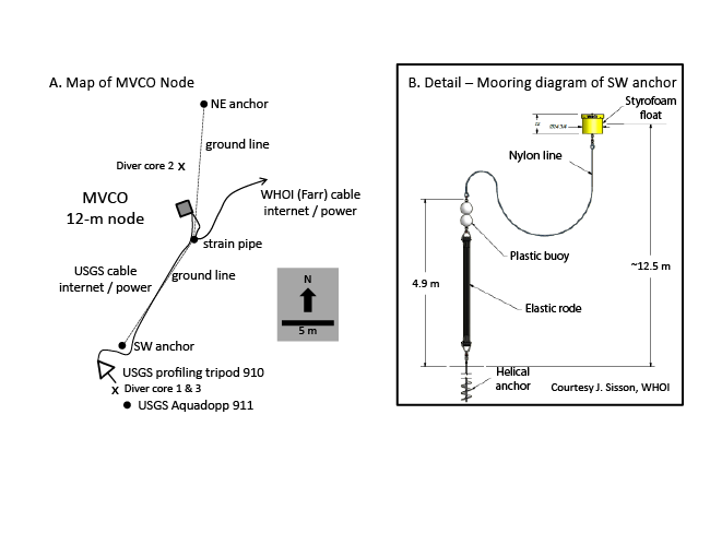
Figure 4. Schematic diagrams showing A, location of node infrastructure and U.S. Geological Survey (USGS) moorings at the Martha's Vineyard Coastal Observatory (MVCO) 12-meter node, and B, detail of mooring diagram of southwest (SW) anchor and buoy at the MVCO, courtesy of Jay Sisson, Woods Hole Oceanographic Institute (WHOI). Refer to the Abbreviations and Symbols section.

Download the full size image in PDF format.


To view files in PDF format, download a free copy of Adobe Reader.


Skip USGS links group

Accessibility FOIA Privacy Policies and Notices

Take Pride in America logo USAGov logo U.S. Department of the Interior | U.S. Geological Survey
End of USGS links group