|
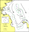
In western Massachusetts Bay
near the outfall site, mixing and transport of water and material into
the regional mean flow pattern is accomplished by a variety of processes,
including the action of tides, winds, and river inflow. The distance particles
travel in a day is typically less than 10 km.
The new outfall is located
in a region generally to the west of the basinwide residual flow pattern.
The residual currents were weak (less than 1 cm/s)
at the Site A, and the
low-frequency fluctuations were not strongly polarized. In contrast, the
mean flow offshore of Scituate (Site B) was stronger, and the low frequency
fluctuations generally aligned parallel to the coast. On the basis of
this flow pattern, currents observed at Site B were thought to be more
representative of the baywide residual circulation pattern, and thus the
additional long-term observations at the Site B were initiated in 1997.
Boston Harbor, Stellwagen
Basin, and Cape Cod Bay are long-term sinks for fine-grained sediments
and associated contaminants. The regional pattern of sedimentary environments
in the Boston Harbor/Massachusetts bays sedimentary system is a result
of the basin geometry, the supply of sediment, and oceanographic processes.
Fine sediments accumulate in the Boston Harbor estuary because of its
restricted flushing and low-wave climate. The inner shelf along the western
shore of Massachusetts Bay (water depths shallower than 40-50 m)
is covered
by deposits of gravel, coarse sands, and bedrock. Fine sediments do not
accumulate here because storm currents resuspend and remove them from
the bottom. The deepest part of the system, Stellwagen Basin, is generally
a tranquil environment where fine-grained sediments accumulate.
Strong storms with winds
from the northeast resuspend fine sediments from western Massachusetts
Bay and transport them offshore and toward Cape Cod Bay. Northeasters,
with winds that blow across the Gulf of Maine, generate large waves that
enter Massachusetts Bay from the east. The oscillatory currents associated
with these waves cause resuspension of the bottom sediments in water depths
less than 40 to 50 m over areas exposed to the northeast, principally
along the western shore of Massachusetts Bay. Typically only a few millimeters
of sediment are resuspended from the seabed during each storm. The currents
driven by winds from the northeast flow southeastward parallel to the
coast (with an offshore component near the bottom) and carry the suspended
sediments toward Cape Cod Bay and offshore into Stellwagen Basin. Sediments
settle to the sea floor along this transport pathway following each storm.
Sediments that reach the
sea floor in Cape Cod Bay or Stellwagen Basin are likely to remain there.
In this coastal system, currents caused by surface waves are the principal
cause of sediment resuspension. Cape Cod Bay is sheltered from large waves
by Cape Cod, and waves are rarely large enough to resuspend sediments
at the seabed in the deep Stellwagen Basin. Thus, once sediments reach
Stellwagen Basin or Cape Cod Bay, carried either by the mean flow or transported
by storms, it is unlikely that they will be resuspended by waves and transported
again.
|