
|
| Click on figures for larger images. |
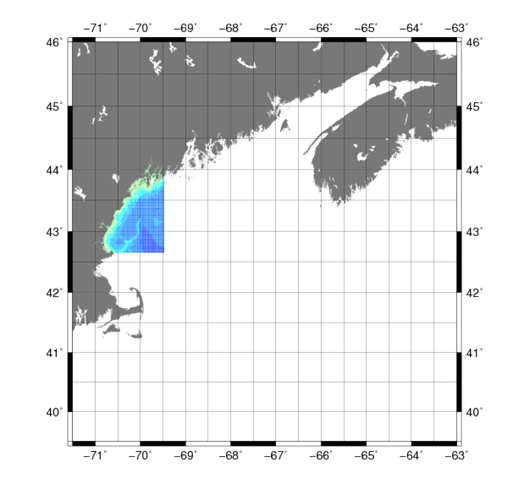 |
Figure 5. Map showing the extent of the U.S. Naval Oceanographic Office Digital Bathymetric Data Base Variable Resolution data for the Gulf of Maine used in the construction of the digital bathymetry grid. |
The Digital Bathymetric Data Base Variable
Resolution (DBDB-V), developed by the Naval Oceanographic Office (NAVO) (Banic, 1995), contains gridded bathymetry at various resolutions, including 0.5-, 1-, 2-,
and 5-arcminutes. The 0.5-arcminute (approximately 900-m) grid (fig. 5)
was used for the construction of the 3 arcsecond DEM.
Data Properties:
- Vertical Datum: MSL
- Vertical Accuracy: Unknown
- Coordinate System: Geographic Decimal Degrees
- Horizontal Datum: WGS84
- Horizontal Accuracy: Unknown
- Resolution: 0.5 arc minute (approximately 900-m)
- Year Data Published: 1996
- Format: ASCII YXZ
- Date Data Downloaded: February 2007
Missing data values (any values indicated with “-9999”) and all land values (values larger than 0) were removed using the
AWK programming utility and written to ASCII XYZ.
The vertical datum was adjusted to NAVD 88 using the method described in Common Processing Steps and Data.
The DBDB-V data provided higher coverage in some areas of the western Gulf of Maine, particularly in a region of unexploded depth charges for which digital GEODAS soundings were not available (fig. 5). |


