
|
| Click on figures for larger images. |
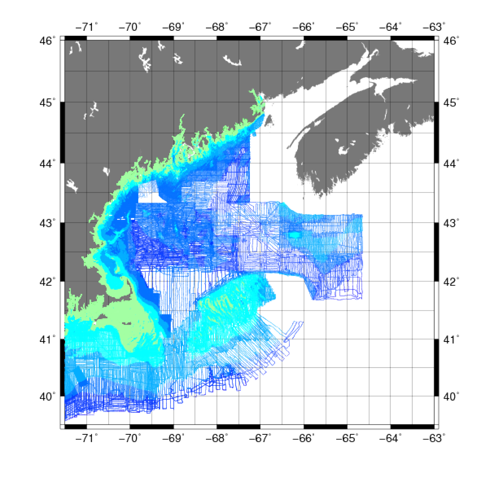 |
Figure 2. Map showing the extent of the hydrographic soundings soundings in the Gulf of Maine from the National Oceanic and Atmospheric Administration National Geophysical Data Center survey from 1859-2008. |
Hydrographic soundings (fig.2) were obtained from National Oceanic and Atmospheric Administration's (NOAA) National Geophysical Data Center (NGDC)
interactive map service (downloaded between January, 2007 and June, 2010). A list of the NOAA surveys used for the bathymetry grid can be found here.
Data Properties:
- Vertical Datum: MLW (before 1980) and MLLW (1980 and later)
- Vertical Accuracy: Unknown
- Coordinate System: Geographic
- Horizontal Datum: NAD 83
- Horizontal Accuracy: Unknown
- Resolution: variable
- Period Covered by Data: 1859 through 2008
- Format: Digital data as ASCII XYZ files, TIFF images of scanned survey sheets
- Date(s) Data Downloaded: February 2007 - November 2011
Nondigital data were digitized by hand from the survey chart images, performing georeferencing using known longitude and latitude points
with ESRI ArcMap 9.2. Individual isobaths were traced to generate a new polyline shapefile. These polylines were then converted to points
by the "Features to Points" XToolsPro (version 4.1.0, build 375)
tool with a point spacing of approximately 90 m. The 6, 12, 18, and 30-foot (ft) (1.8, 3.7, 5.5, and 9.1-m) isobaths were digitized and
output to ASCII XYZ format.
Depth values greater than 400 m and with locations closer than 1,000 m to the higher resolution University of New Hampshire data were removed, as described in the Common Processing Steps and Data section, resulting in significant improvement along the south side of Georges Bank.
The vertical datum was converted to NAVD88, as described in the Common Processing Steps and Data section.
|


