
|
| Click on figures for larger images. |
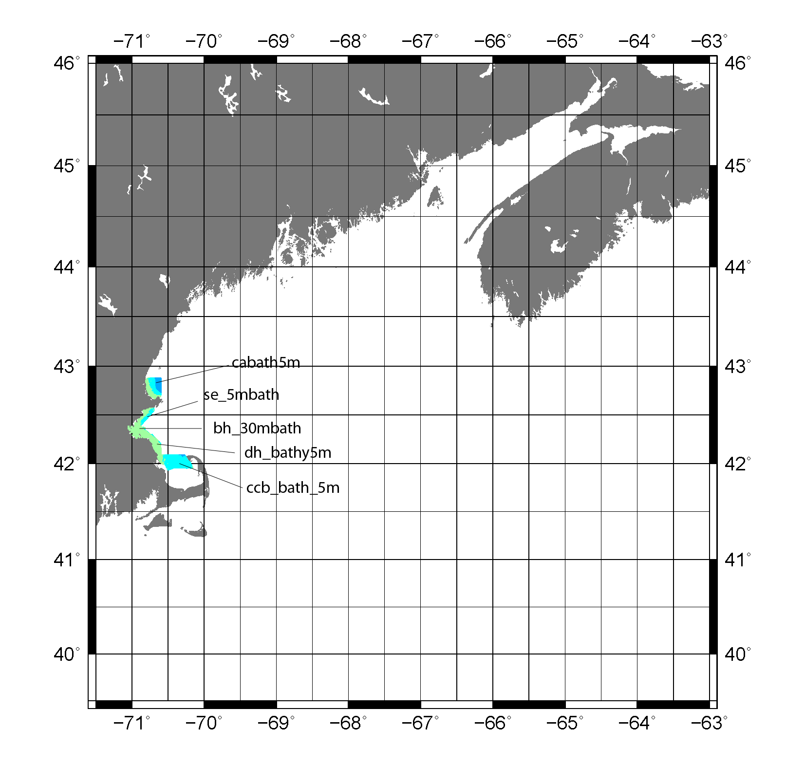 |
Figure 12. Map showing the extent of the geologic mapping data for the Gulf of Maine from the Massachusetts Seafloor Mapping Cooperative by the U.S. Geological Survey and the Massachusetts Office of Coastal Zone Management. |
In cooperation with the Massachusetts Office of Coastal Zone Management (CZM),
NOAA, the University of New Brunswick,
UNH, and the CHS, the
U.S Geological Survey (USGS) is conducting geologic mapping of the seafloor offshore Massachusetts to characterize the surface and subsurface geologic
framework. The long-term goal of this mapping effort is to produce high-resolution
geologic maps and a Geographic Information System (GIS) that will serve the needs of research, management
and the public. (U.S. Geological Survey 2011)
Nahant-Gloucester, Boston Harbor,
Cape Ann-Salisbury, Duxbury-Hull,
and Northern Cape Cod Bay were surveyed as part of the program (fig. 12).
Data Properties:
- Vertical Datum: MLLW
- Vertical Accuracy: 0.2 m
- Coordinate System: UTM Zone 19
- Horizontal Datum: WGS84
- Horizontal Accuracy: ± 2 m
- Resolution: 5 m (cabath5m, ccb_bath_5m, dh_bathy5m, se_5mbath), 30 m (bh_30mbath)
- Period Covered by Data: 2001 (bh_30mbath), 2005 (cabath_5m), 2006 (ccb_bath_5m), 2007 (dh_bathy5m), 2008 (se_5mbath)
- Format: ESRI Grid 32 Bit Floating Point
- Date Data Downloaded: June 2011
The ESRI 32-bit floating point grid was converted to geographic coordinates (degrees) using the
GDAL gdalwarp tool,
with output saved in GMT .grd format. The GMT grid was then converted to ASCII XYZ format
using the GMT grd2xyz tool.
The vertical datum was adjusted to NAVD88 using the method described in Common Processing Steps and Data.
The data had to be processed to a coarser resolution of 30 m due to the large size of the 5 m resolution
files. GMT blockmedian command
was used to decrease the resolution from 5 m to 30 m using a grid spacing of 30 m for the region of interest (71°30' to 63° W, 39°30' to 46° N). For more information on blockmedian, see
Common Processing Steps and Data.
|


