
|
| Click on figures for larger images. |
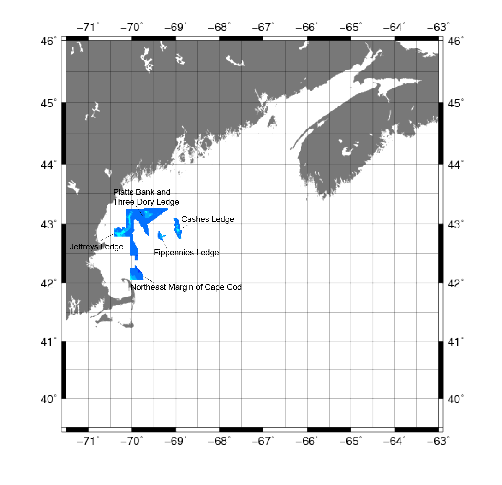 |
Figure 4. Map showing the extent of the data for the Gulf of Maine collected from 1998, 2002, and 2005 by the binational Gulf of Maine Mapping Initiative used in the construction of the digital bathymetry grid. |
The Gulf of Maine Mapping Initiative (GOMMI) is a partnership of American
and Canadian government and nongovernment organizations formed to conduct comprehensive seafloor imaging, mapping, and biological and geological
surveys. The partnerships include
National Oceanic and Atmospheric Administration (NOAA) ,
University of New Hampshire (UNH) and
Science
Applications International Corporation (SAIC).
Data Properties:
- Vertical Datum: Mean Sea Level (MSL)
- Vertical Accuracy: Unknown
- Coordinate System: Universal Transverse Mercator (UTM)
- Horizontal Datum: NAD 83
- Horizontal Accuracy: Unknown
- Resolution: 5 m
- Period Covered by Data: 1998 (Northeast margin of Cape Cod), 2002 (Jeffries Ledge), and 2005 (Cashes Ledge, Platts Bank, and Three Dory Ledge)
- Format: ASCII XYZ
- Date Data Downloaded: December 2008
The following data sets (fig. 4) used for the bathymetry grid were provided by NOAA:
| Data set |
Sources |
| Cashes Ledge |
NOAA, UNH |
| Platts Bank and Three Dory Ledge |
NOAA, UNH |
| Northeast Margin of Cape Cod |
NOAA, UNH |
| Jeffries Ledge |
SAIC, UNH, NOAA |
| Fippennies Ledge |
NOAA, UNH |
The projected UTM data (in meters) were converted to geographic coordinates (in degrees) using
the PROJ4 cartographic projections
library.
The vertical datum was adjusted to NAVD88 using the method described in Common Processing Steps and Data.
The resulting approximately 5-m resolution data were condensed to 1-arcsecond resolution using the GMT
blockmedian
command, then output as ASCII XYZ for use in construction of the 3-arcsecond grid. This allowed the GOMMI data to still dominate blockmedian values in the 3-arcsecond grid, but allowed for significantly faster processing.
For more information on blockmedian, see Common Processing Steps and Data.
|


